

Arkansas map
Arkansas Ozarks map
The sheet's index lists 8 highways; I-49, I-42 and US 62 cross the most grid squares. Things to do inside the boundary: 1886 Crescent Hotel & Spa, Arkansas Air & Military Museum and Blanchard Springs Caverns. Also on it: Batesville, Bella Vista and Bentonville.
Open the map (PDF, US Letter)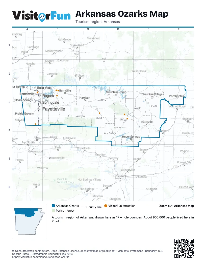
Highway index of Arkansas Ozarks
Each highway on the sheet and the grid squares it crosses.
- I-42A3
- I-49A2, A3, A4
- US 62A3
- US 71A3
- US 71BA3
- US 412A3
- AR 16A3
- AR 642A3
Things to do on the Arkansas Ozarks map
- 1886 Crescent Hotel & Spa
- Arkansas Air & Military Museum
- Blanchard Springs Caverns
- Blue Spring Heritage Center
- Buffalo National River
- Christ of the Ozarks
- Crystal Bridges Museum of American Art
- Devil's Den State Park
- Mammoth Spring State Park
- Northwest Arkansas Mall
- Old Spanish Treasure Cave
- Ozark Folk Center State Park
- Ozark Gateway Region
- Pea Ridge National Military Park
- Scott Family Amazeum
- Shiloh Museum of Ozark History
- The Walmart Museum
- Thorncrown Chapel
- Turpentine Creek Wildlife Refuge
Places on the map
- Batesville
- Bella Vista
- Bentonville
- Berryville
- Cherokee Village
- Fayetteville
- Harrison
- Heber Springs
- Mountain Home
- Pocahontas
- Prairie Grove
- Rogers
- Siloam Springs
- Springdale
- Sulphur Springs
Next to Arkansas Ozarks
- Arkansas Capital map
- Arkansas Delta map
- Arkansas River Valley map
- Southeast Missouri
- Southwest Missouri
- Green Country
© OpenStreetMap contributors, Open Database License, openstreetmap.org/copyright · Map data: Protomaps · Boundary: U.S. Census Bureau, Cartographic Boundary Files 2024