

California map
Mendota map
About 12,623 people live here (Census Bureau, 2024 estimate). The sheet's index lists 91 streets; Derrick Avenue, Marie Street and I Street cross the most grid squares. Also on it: Lindgren-Lozano Park, McCabe Elementary School and Mendota City Hall.
Open the map (PDF, US Letter)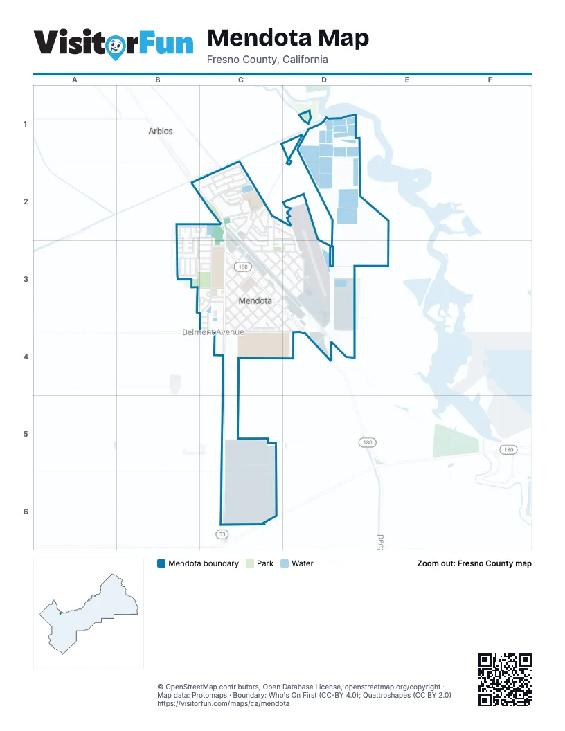
Street index of Mendota
Each street on the sheet and the grid squares it crosses.
- Bass AvenueD1, C2
- Cantu StreetB2
- Castro StreetB2
- Cervantez StreetB2, B3
- Diaz StreetB2
- Gonzalez StreetB2, C2
- Holmes AvenueB2, C2
- Petry StreetB2, B3
- Quiroga CourtB2
- 2nd CourtC2
- 2nd StreetC2, C3
- 4th CourtC2
- 4th StreetC2, C3
- Barboza StreetC2
- Blanco StreetC2
- Bou CircleC2
- De la Cruz StreetC2
- Derrick AvenueC2, C3, C4, C5, C6
- Garcia StreetC2
- Gaxiola StreetC2
- Gomez StreetC2
- Gurrola AvenueC2
- H StreetC2
- Hernandes StreetC2
- I StreetC2, D2, D3
- J StreetC2, D2
- K StreetC2, C3
- L StreetC2, C3, D3
- Lozano StreetC2
- Marie StreetC2, C3, D3, D4
- Naples StreetC2, C3, D3
- North Kate StreetC2, C3
- Perez StreetC2
- Rios StreetC2
- Santa Fe GradeC2
- Sorensen AvenueC2, C3, C4
- Bandoni CourtB3
- Barajas CourtB3
- Black AvenueB3, C3
- Castaneda StreetB3
- Fleming AvenueB3, C3
- Maldonado StreetB3
- Martinez CourtB3
- McCabe AvenueB3, C3
- Oxnard StreetB3
- San Pedro StreetB3
- Santa Cruz StreetB3
- Silva StreetB3
- Smoot AvenueB3, C3
- Valenzuela StreetB3
- 10th StreetC3, D3, C4
- 3rd StreetC3
- 5th StreetC3
- 6th StreetC3, D3
- 7th StreetC3, D3, C4
- 8th StreetC3, D3, C4
- 9th StreetC3, D3, C4
- Arnaudon DriveC3
- Divisadero StreetC3, D3
- Gregg Court NorthC3
- Gregg Court SouthC3
- Gregg Court WestC3
- Kate CourtC3
- Kate StreetC3, D3
- Locust AvenueC3
- Lolita StreetC3, D3
- Oller StreetC3, D3, D4
- Peach AvenueC3, C4
- Puchue StreetC3, C4, D4
- Quince StreetC3, C4
- Rio Frio StreetC3, C4
- Sorensen CircleC3
- Stamoules StreetC3, C4
- Straw StreetC3
- Tuft StreetC3
- Tule StreetC3, C4
- 11th StreetD3, C4
- Airport BoulevardD3
- Canal StreetD3
- Divisadero CircleD3
- Inez StreetD3
- Juanita StreetD3
- North Juanita StreetD3
- Ash AvenueC4
- Belmont AvenueC4, D4
- Elm AvenueC4
- Jennings CircleC4
- Jennings StreetC4
- Unida StreetC4
- North Naples StreetD4
- West Panoche RoadC6
Places on the map
- AMOR Wellness Neighborhood Resource Center
- AutoZone
- Burger King
- Dollar General
- Dollar Tree
- Family Dollar
- Fresno County Fire Department Station #96
- Garcia's Market
- Jess Gill Park
- Lindgren-Lozano Park
- McCabe Elementary School
- McDonald's
- Mendota City Hall
- Mendota Continuation High School
- Mendota Elementary School
- Mendota High School
- Mendota Junior High School
- Mendota Post Office
- Rojas Amphitheater
- Rojas Pierce Park
- Star Super Market
- Starbucks
- Veterans Gazebo
- Veterans Park
- Veterans Park Playground
- Washington Elementary School
- William Robert Johnston Municipal Airport
Next to Mendota
- Arbios
© OpenStreetMap contributors, Open Database License, openstreetmap.org/copyright · Map data: Protomaps · Boundary: Who's On First (CC-BY 4.0); Quattroshapes (CC BY 2.0)















