

California map
Salinas Metro Area map
The sheet's index lists 5 highways; US 101, CA 1 and CA 68 cross the most grid squares. Things to do inside the boundary: Bixby Bridge, Cannery Row and Carmel Mission Basilica. Also on it: East Garrison, Gonzales and Greenfield.
Open the map (PDF, US Letter)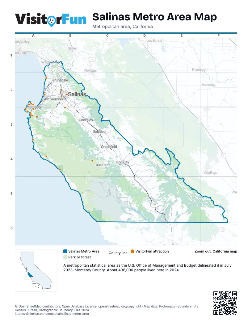
Highway index of Salinas Metro Area
Each highway on the sheet and the grid squares it crosses.
- US 101B1, B2, B3, C3, C4, D4, D5, D6, E6
- CA 1A1, A2, A3
- CA 68A3, B2, B3
- CA 156A2, B1, B2
- CA 183A2, B2
Things to do on the Salinas Metro Area map
- 17-Mile Drive
- Bixby Bridge
- Cannery Row
- Carmel Mission Basilica
- Julia Pfeiffer Burns State Park
- Monterey Bay Aquarium
- Monterey Bay Whale Watch
- Old Fisherman's Grotto
- Old Fisherman's Wharf
- Pebble Beach Golf Links
- Princess Monterey Whale Watching
- Bruno's Market & Deli
- Cafe Fina
- Cannery Row Antique Mall
- Carmel Plaza
- Central Coast Scuba
- Chris' Fishing and Whale Watching
- Del Monte Center
- Discovery Whale Watch
- Fishwife
- Links Club
- Little Mermaid Glass Bottom Boat Tours
- Monterey Bay Eco Tours
- Monterey Bay Equestrian Center
- Monterey Mirror Maze
- Monterey Touring Vehicles
- Monterey Zoo
- Northridge Mall
- Pacific Grove Museum of Natural History
- Refuge
- Salinas City Center
- Sanctuary Cruises
- Sea Goddess Whale Watching
- The Crossroads Carmel
Places on the map
- East Garrison
- Gonzales
- Greenfield
- King City
- Monterey
- Prunedale
- Salinas
- Soledad
© OpenStreetMap contributors, Open Database License, openstreetmap.org/copyright · Map data: Protomaps · Boundary: U.S. Census Bureau, Cartographic Boundary Files 2024















