

Colorado map
El Paso County map
About 752,772 people live here (Census Bureau, 2024 estimate). The sheet's index lists 7 streets; Ronald Reagan Highway, North Powers Boulevard and Monument Valley Highway cross the most grid squares. Things to do inside the boundary: Cave of the Winds Mountain Park, Cheyenne Mountain Zoo and Colorado Springs.
Open the map (PDF, US Letter)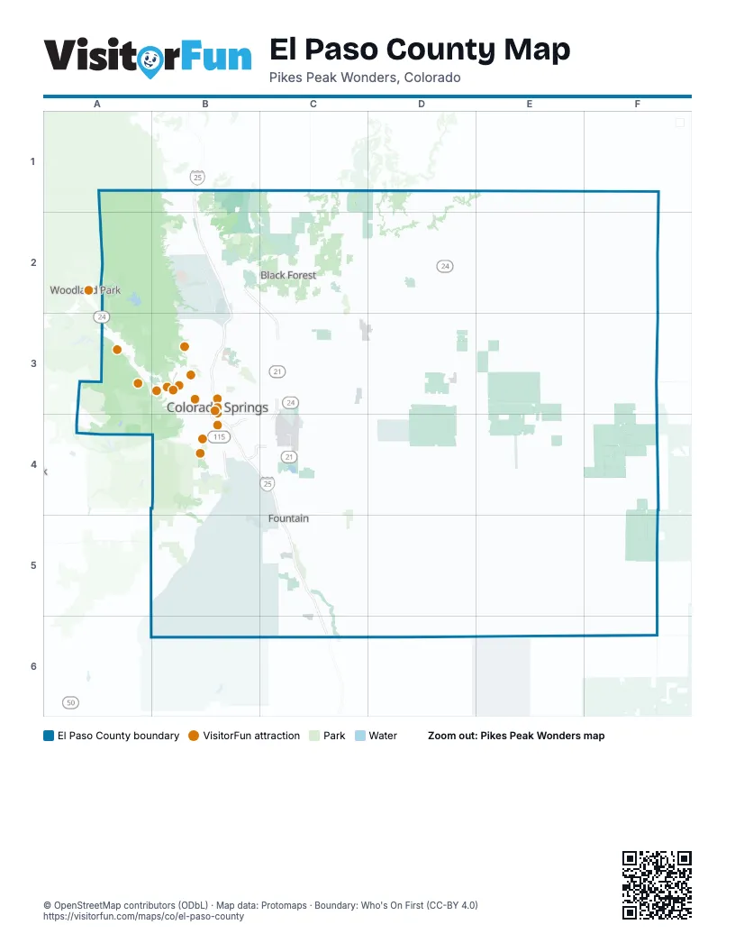
Maps inside El Paso County
1 map inside, from the street map of El Paso County down.
Street index of El Paso County
Each street on the sheet and the grid squares it crosses.
- Ronald Reagan HighwayB1, B2, B3, B4, C4, C5, C6
- North Powers BoulevardB2, C3
- Monument Valley HighwayB3, B4
- South Powers BoulevardC3, C4
- Martin Luther King Junior ExpresswayB4
- Milton E. Proby ParkwayB4, C4
- South Academy BoulevardB4
Things to do on the El Paso County map
- Cave of the Winds Mountain Park
- Cheyenne Mountain Zoo
- Colorado Springs
- Colorado Springs Visitor Information Center
- Downtown Colorado Springs
- Edelweiss Restaurant
- Edward C. Rochette Money Museum
- Flying W Ranch
- Garden of the Gods
- Garden of the Gods Trading Post
- Manitou Cliff Dwellings Museum
- Manitou Incline
- Manitou Springs
- Open Road Rentals
- Pikes Peak - America's Mountain
- Pikes Peak Region Attractions Association
- Rocky Mountain Food Tours
- The Broadmoor
- US Olympic & Paralympic Museum
Places on the map
- Abert Estates
- Aiken Canyon Preserve
- Antelope Meadows
- Antler Creek Golf Course
- Audubon Gardens
- Austin Estates
- Bear Creek Cañon Park
- Bear Creek Regional Park
- Big Johnson Reservoir
- Black Forest
- Black Forest Estates
- Black Forest Regional Park
- Black Forest Reserve
- Black Forest Section 16
- Blackmer Loop
- Blodgett Peak Open Space
- Bluestem Prairie Open Space
- Bonnyville
- Bridle Bit Ranch
- Bridlewood
- Bristlecone Lake
- Broadmoor Cheyenne
- Butts Army Airfield
- Camelot
- Canyon View
- Cascade-Chipita Park
- Cathedral Pines
- Cedar Heights
- Century Heights
- Charleston Place
- Cherry Creek Crossing
- Cherry Creek Springs
- Cheyenne Mountain
- Cheyenne Mountain Center
- Cheyenne Mountain State Park
- Cheyenne Shadows Golf Course
- Clear Spring Ranch Park
- Colorado Country
- Colorado Springs
- Colorado Springs Country Club
Next to El Paso County
- Woodland Park
© OpenStreetMap contributors (ODbL) · Map data: Protomaps · Boundary: Who's On First (CC-BY 4.0)