

Delaware map
Southern Delaware map
The sheet's index lists 13 highways; DE 1, US 113 and DE 404 cross the most grid squares. Things to do inside the boundary: Beef Jerky Experience Rehoboth Beach, Bethany Beach & Fenwick Island and Cape Henlopen State Park. Also on it: Bayville, Bethel and Bridgeville.
Open the map (PDF, US Letter)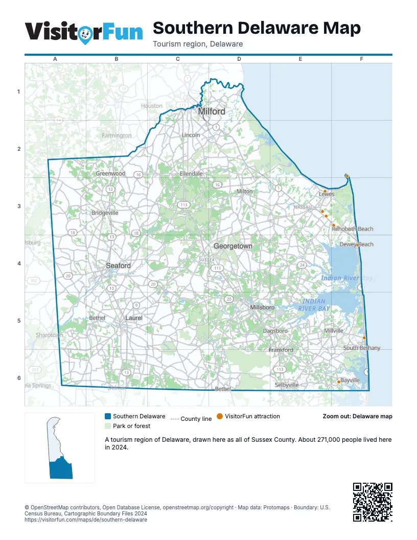
Highway index of Southern Delaware
Each highway on the sheet and the grid squares it crosses.
- US 9B5, C4, D3, D4, E3, F3
- US 13B2, B3, B4, B5, B6
- US 113C1, C2, C3, C4, D4, D5, E5, E6
- DE 1C1, C2, D2, D3, E3, F3, F4, F5, F6
- DE 1DE3
- DE 5D3, E4
- DE 16B2, C2, D2, D3
- DE 18A3, A4, B3, C4
- DE 20A4, B4, C4, C5, D5, E5
- DE 24D5, E3, E4, E5
- DE 26D5, E5, F5
- DE 36B2, C1
- DE 404A2, A3, B3, C4, D3, D4, E3
Things to do on the Southern Delaware map
- Beef Jerky Experience Rehoboth Beach
- Bethany Beach & Fenwick Island
- Cape Henlopen State Park
- Cape Water Tours
- Delaware Botanic Gardens
- Dewey Beach Parasail
- Dogfish Head Craft Brewery
- Freeman Arts Pavilion
- Lewes Canalfront Park
- Lewes Historical Society
- Lightship Overfalls
- Marvel Carriage Museum
- Midway Par 3 Golf
- Midway Speedway Park
- Rehoboth Beach and Dewey Beach
- Shell We Golf
- Tanger Outlets Rehoboth Beach
- The Sea Shell Shop
- Trap Pond State Park
Places on the map
- Bayville
- Bethel
- Bridgeville
- Dagsboro
- Dewey Beach
- Ellendale
- Frankford
- Georgetown
- Greenwood
- Laurel
- Lewes
- Lincoln
- Milford
- Millsboro
- Millville
- Milton
- Rehoboth Beach
- Seaford
- Selbyville
- South Bethany
Next to Southern Delaware
- Central Delaware
- Eastern Shore
© OpenStreetMap contributors, Open Database License, openstreetmap.org/copyright · Map data: Protomaps · Boundary: U.S. Census Bureau, Cartographic Boundary Files 2024