

Delaware map
Delaware map
Things to do inside the boundary: Air Mobility Command Museum, Beef Jerky Experience Rehoboth Beach and Bethany Beach & Fenwick Island. Also on it: Assawoman Canal, Baywood Greens Golf Course and Blackbird State Forest. Just past the edge: Atlantic City, Bridgeton and Cambridge.
Open the map (PDF, US Letter)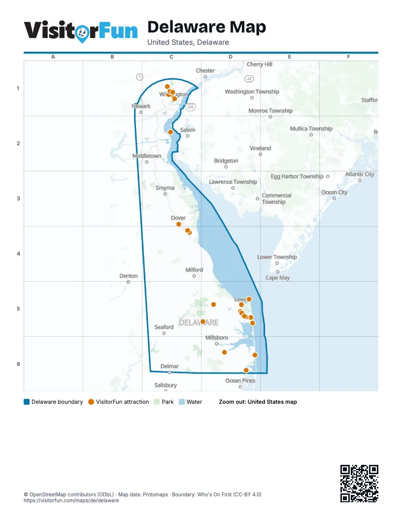
Maps inside Delaware
2 maps inside, from the street map of Delaware down.
Things to do on the Delaware map
- Air Mobility Command Museum
- Beef Jerky Experience Rehoboth Beach
- Bethany Beach & Fenwick Island
- Cape Henlopen State Park
- Cape Water Tours
- Delaware Art Museum
- Delaware Botanic Gardens
- Delaware Museum of Nature & Science
- Dewey Beach Parasail
- Dogfish Head Craft Brewery
- First State Heritage Park Welcome Center and Galleries
- Fort Delaware
- Freeman Arts Pavilion
- Hagley Museum and Library
- Lightship Overfalls
- Midway Par 3 Golf
- Midway Speedway Park
- Nemours Estate
- Rehoboth Beach and Dewey Beach
- Shell We Golf
- Southern Delaware
- Tanger Outlets Rehoboth Beach
- The Sea Shell Shop
- Wilmington & the Brandywine Valley
- Winterthur Museum, Garden & Library
Places on the map
- Assawoman Canal
- Baywood Greens Golf Course
- Blackbird State Forest
- Blackiston Wildlife Area
- Bombay Hook National Wildlife Refuge
- Cape Henlopen State Park
- Cedar Swamp Wildlife Area
- Delaware National Estuarine Research Reserve
- Dover Air Force Base
- First State National Historical Park
- Great Cypress Swamp
- Heritage Shores Club
- Killens Pond State Park
- Midlands Wildlife Area
- New Castle County Airport
- Prime Hook National Wildlife Refuge
- Taber State Forest
- White Clay Creek State Park
Next to Delaware
- Atlantic City
- Bridgeton
- Cambridge
- Cape May
- Centreville
- Chester
- Chestertown
- Commercial Township
- Delmar
- Denton
- Easton
- Edgewood
- Egg Harbor Township
- Havre de Grace
- Lawrence Township
- Lower Township
- Monroe Township
- Mullica Township
- Ocean City
- Ocean Pines
- Oxford
- Pleasantville
- Saint Michaels
- Salem
- Stevensville
- Vineland
- Washington Township
© OpenStreetMap contributors (ODbL) · Map data: Protomaps · Boundary: Who's On First (CC-BY 4.0)