

Florida map
Lake County map
About 444,204 people live here (Census Bureau, 2024 estimate). The sheet's index lists 3 streets; Wekiva Parkway, Florida's Turnpike and FL 516 Toll cross the most grid squares. Also on it: Alexander Springs, Alexander Springs Wilderness and Alice Lockmiller Parcel.
Open the map (PDF, US Letter)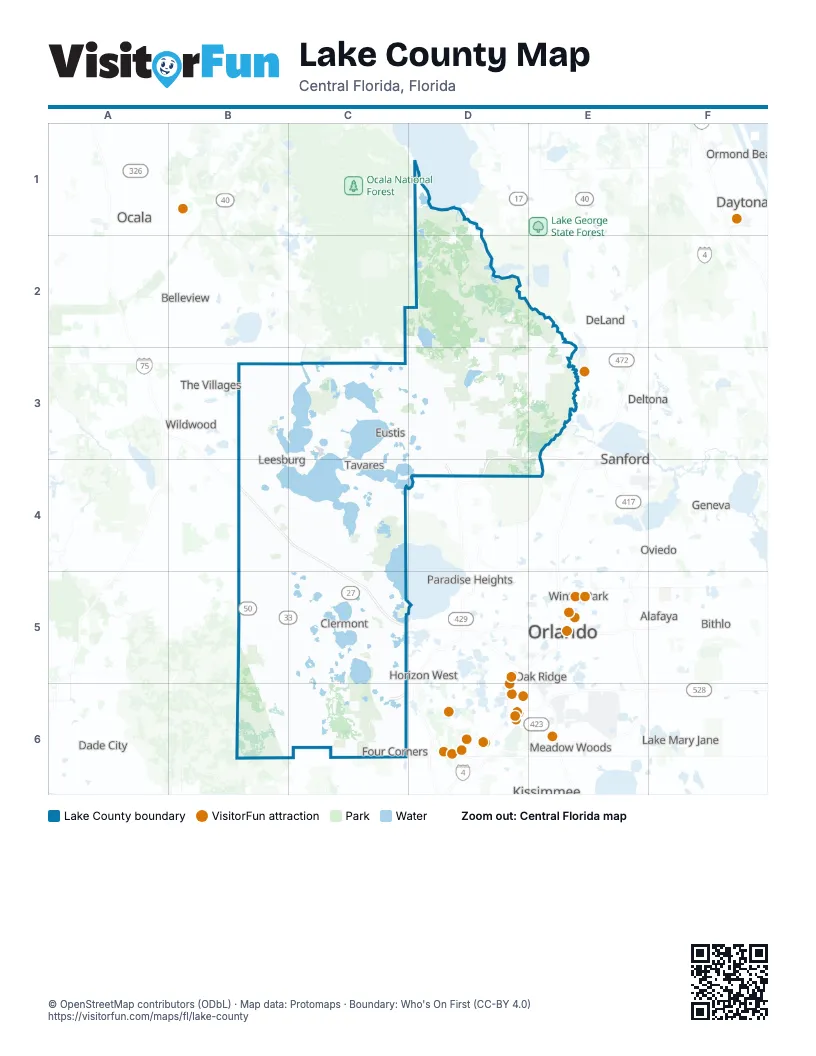
Street index of Lake County
Each street on the sheet and the grid squares it crosses.
- Wekiva ParkwayD3, E3, D4, E4
- Florida's TurnpikeB4, C4, C5
- FL 516 TollC6
Places on the map
- Alexander Springs
- Alexander Springs Wilderness
- Alice Lockmiller Parcel
- Alligator Lake Swamp
- Altoona
- Arlington Ridge Golf Club
- Astatula
- Astor
- Bay Lake
- Big Creek
- Billies Bay Wilderness
- Black Bear Golf Club
- Black Water Creek Swamp
- Black Water Swamp
- Blazing Star Circle
- Botts Creek
- Brautcheck Flowage Easement
- Central Sand 474
- Cherry Lake
- Clermont
- Clermont National
- Crescent Lake
- Cypress Lake
- Dead River
- Dixie Lake
- Double Run Preserve
- East Crooked Lake
- East Lake Harris Estates Canal
- El Campéon
- Ellis Acres Reserve
- Emeralda Marsh Conservation Area
- Eustis
- Fern Prairie Preserve
- Ferndale
- Ferndale Preserve
- Flat Lake
- Florida's Natural Growers
- Fruitland Park
- Gator Hole
- Grand Oaks Resort
Next to Lake County
- Alafaya
- Belleview
- Bithlo
- Celebration
- Dade City
- Daytona Beach
- DeLand
- Deltona
- Geneva
- Horizon West
- Hunters Creek
- Kissimmee
- Lake Hart
- Lake Mary Jane
- Meadow Woods
- Midway
- Oak Ridge
- Ocala
- Orlando map
- Ormond Beach
- Oviedo
- Paradise Heights
- Pine Hills
- Sanford
- The Villages
- Union Park
- University
- Wildwood
- Winter Park
- Winter Springs
© OpenStreetMap contributors (ODbL) · Map data: Protomaps · Boundary: Who's On First (CC-BY 4.0)