

Iowa map
Boone County map
About 26,729 people live here (Census Bureau, 2024 estimate). The sheet's index lists 70 streets; 130th Street, H Avenue and D Avenue cross the most grid squares. Things to do inside the boundary: Rail Explorers Boone.
Open the map (PDF, US Letter)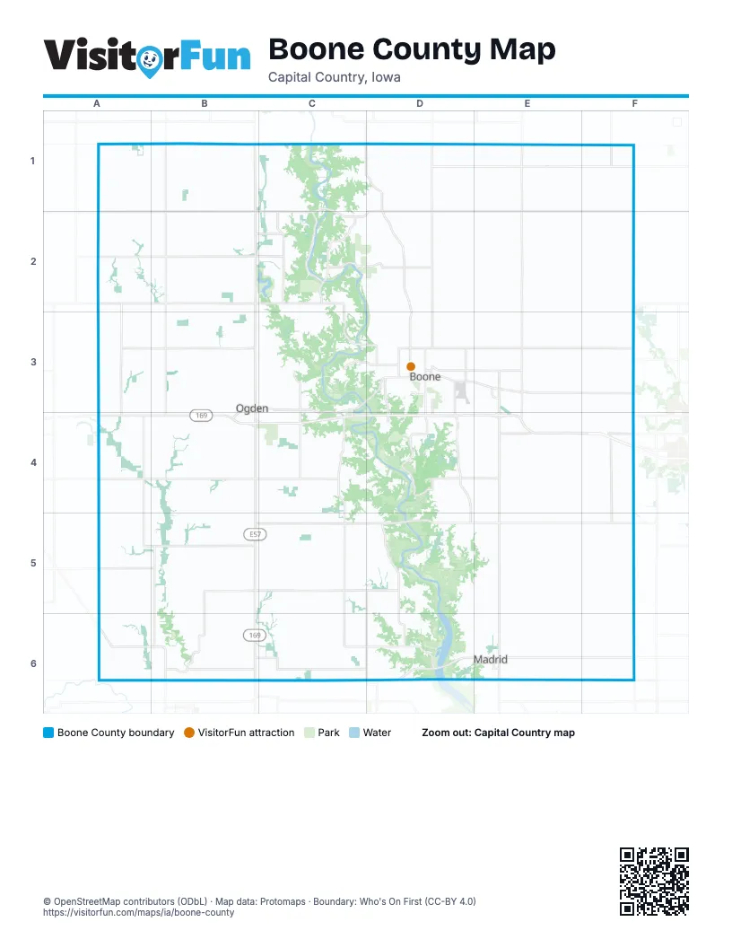
Maps inside Boone County
1 map inside, from the street map of Boone County down.
Street index of Boone County
Each street on the sheet and the grid squares it crosses.
- 130th StreetA1, B1, C1, D1, E1, F1, A2, B2, C2, D2, E2
- D AvenueB1, B2, B3, B4, B6
- H AvenueB1, B2, B3, B4, B5, B6
- Taylor AvenueB1
- Chase AvenueD1
- Fenton AvenueD1
- Nature RoadD1, D2, D3
- P AvenueD1, D2, D3, D4
- Briggs Woods RoadE1
- T AvenueE1, E2, E3, E4
- 170th StreetA2, B2, C2
- L AvenueC2, C3, C4, C5, C6
- Y AvenueF2, F3, E6, F6
- CR E41 RoadB3, B4
- East Walnut StreetB3, C3
- North 1st StreetB3
- South 1st StreetB3, B4
- West Walnut StreetB3
- 188th RoadC3, D3
- 216th DriveC3, D3, C4
- 216th StreetC3
- Lion AveC3, C4
- 190th StreetD3, E3, F3
- 22nd StreetD3
- Corporal Roger Snedden DriveD3, D4
- Mallard AvenueD3
- Mamie Eisenhower AvenueD3, E3
- Marion StreetD3
- Old Highway 30D3
- South Story StreetD3, D4
- Story StreetD3
- West 12th StreetD3
- West 22nd StreetD3
- West 3rd StreetD3
- West Mamie Eisenhower AvenueD3
- 200th StreetE3
- 210th StreetE3
- Robin RoadE3
- S AvenueE3, E4
- Y Avenue;N 500th AvenueF3
- 220th StreetA4, B4, C4, D4, E4
- C AvenueA4, A5
- Co E41 RoadB4
- 230th StreetD4, E4, F4
- 250th StreetD4, E4
- 255th StreetD4
- Oriole RoadD4
- Quill AvenueD4, D5
- 280th AvenueA5, B5
- 290th StreetA5, B5
- 270th StreetB5, C5, D5, E5, F5
- 280th StreetB5
- Clover AvenueB5, B6
- Boone StreetE5
- 144 DiagonalA6
- 325th StreetA6, B6, C6, D6
- Apple RoadA6
- J AvenueB6
- County Highway R18C6
- 334th RoadD6, E6
- M AvenueD6
- North Main StreetD6
- 330th StreetE6, F6
- East 1st StreetE6
- East North StreetE6
- North Kennedy AvenueE6
- South Kennedy AvenueE6
- State Highway 17E6
- West North StreetE6
- 6th AvenueF6
Things to do on the Boone County map
Places on the map
- AgReliant Genetics
- Amaqua Township
- Angus, Iowa
- Barkley Memorial State Forest
- Beaver
- Beaver Township
- Berkley
- Boone
- Boone Business Park
- Boone County
- Boone County Fairgrounds
- Boone County Landfill
- Boone County Waterfowl Production Area
- Boone Municipal Airport
- Boxholm
- Buffalo Grove
- Camp Hantesa
- Camp Mitigwa
- Cass Township
- Cedar Pointe Golf Course
- Centerville, Iowa
- Colfax Township
- Country Aire Mobile Home Park
- Dalander Park Prairie
- Des Moines Township
- Des Moines YMCA Camp
- Dickcissel Recreation Area
- Dodge Township
- Don Williams Golf Course
- Don Williams Lake
- Don Williams Park
- Douglas Township
- Fareway
- Fraser
- Garden Township
- Grant Township
- Harrison Township
- High Trestle Trail
- Holst State Forest
- Honey Creek Golf Club
© OpenStreetMap contributors (ODbL) · Map data: Protomaps · Boundary: Who's On First (CC-BY 4.0)