

Iowa map
Capital Country map
The sheet's index lists 12 highways; I-80, US 6 and I-35 cross the most grid squares. Things to do inside the boundary: Adventureland, Blank Park Zoo and Des Moines Art Center. Also on it: Adel, Altoona and Ames.
Open the map (PDF, US Letter)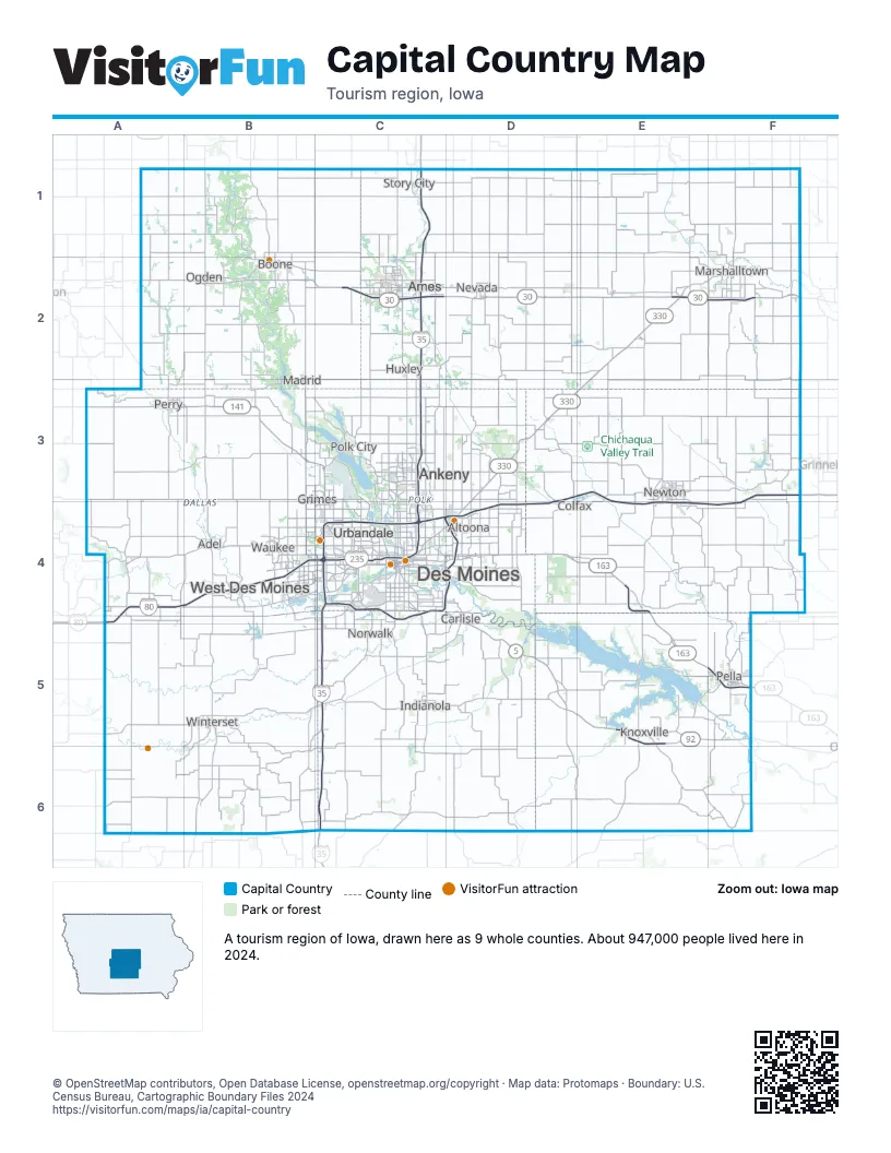
Highway index of Capital Country
Each highway on the sheet and the grid squares it crosses.
- I-35C1, C2, C3, C4, C5, C6
- I-80A4, B4, C4, D3, D4, E3, E4, F3, F4
- I-235C4
- US 6A4, B4, C4, D3, D4, E3, E4
- US 30A2, B2, C2, D2, E2, F2
- US 65C4, D3, D4
- US 169A1, A2, B2, B3, B4
- IA 5C4, D4, D5, E5
- IA 92D5, E5, F5
- IA 141B3, C3, C4
- IA 163D4, E4, E5, F5
- IA 330D3, D4, E2, E3
Things to do on the Capital Country map
- Adventureland
- Blank Park Zoo
- Des Moines Art Center
- Elk Rock State Park
- Greater Des Moines Botanical Garden
- Iowa State Capitol
- John Wayne Birthplace & Museum
- Lake Ahquabi State Park
- Ledges State Park
- Living History Farms
- Outlets of Des Moines
- Pappajohn Sculpture Park
- Prairie Meadows Casino, Racetrack & Hotel
- Rail Explorers Boone
- Reiman Gardens
- Rock Creek State Park
- Roseman Covered Bridge
- Walnut Woods State Park
Places on the map
- Adel
- Altoona
- Ames
- Ankeny
- Boone
- Carlisle
- Colfax
- Des Moines
- Grimes
- Huxley
- Indianola
- Knoxville
- Madrid
- Marshalltown
- Nevada
- Newton
- Norwalk
- Ogden
- Pella
- Perry
- Polk City
- Story City
- Urbandale
- Waukee
- West Des Moines
- Winterset
Next to Capital Country
© OpenStreetMap contributors, Open Database License, openstreetmap.org/copyright · Map data: Protomaps · Boundary: U.S. Census Bureau, Cartographic Boundary Files 2024