

Iowa map
Des Moines Township map
About 213,096 people live here (Census Bureau, 2024 estimate). The sheet's index lists 87 streets; Northwest Granger Drive, Zook Spur Road and T Avenue cross the most grid squares. Also on it: Hindu Temple & Cultural Center of Iowa, Robbins Chapel Cemetery and Whistlin' Donkey.
Open the map (PDF, US Letter)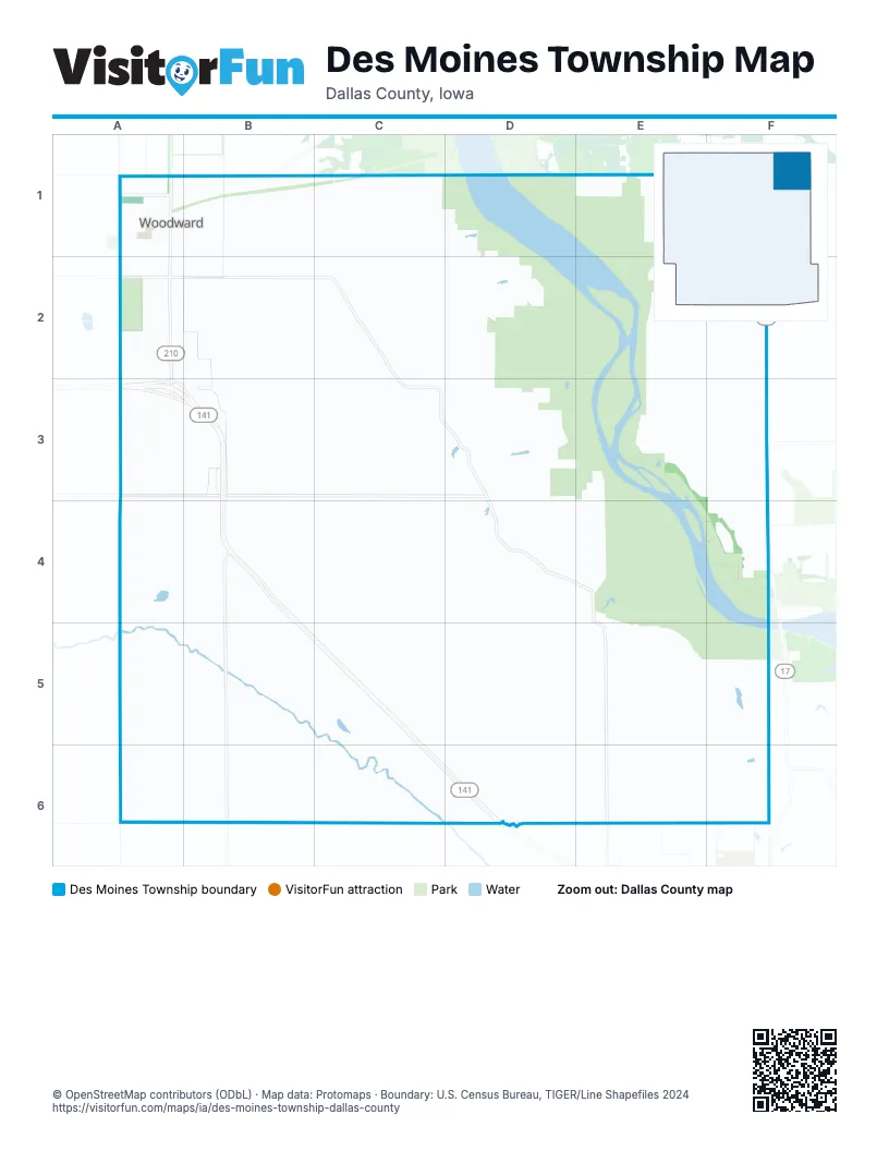
Street index of Des Moines Township
Each street on the sheet and the grid squares it crosses.
- Ash AvenueA1
- Ash StreetA1
- Cedar AvenueA1
- Cherry AvenueA1
- East 1st StreetA1, B1
- East 2nd StreetA1, B1
- East 3rd StreetA1, B1
- East 4th StreetA1, B1
- East 5th StreetA1, B1
- East 6th StreetA1
- Elm AvenueA1
- Maple AvenueA1, A2
- North 2nd StreetA1
- North 3rd StreetA1
- North Cherry AvenueA1
- North Main StreetA1, A2, A3
- North Maple AvenueA1
- North Walnut AvenueA1
- Pine AvenueA1
- Railroad StreetA1, B1
- South Cedar AvenueA1, A2
- South Cherry AvenueA1, A2
- South Main StreetA1, A2
- South Maple AvenueA1
- South Walnut AvenueA1, A2
- Walnut AvenueA1
- West 2nd StreetA1
- West 3rd StreetA1
- West 4th StreetA1
- West 5th StreetA1
- West 6th StreetA1
- 125th PlaceB1, C1
- Birch AvenueB1
- Locust AvenueB1
- Oak AvenueB1
- South 2nd StreetB1
- 130th CourtC1, C2, D2
- O AvenueC1
- U AvenueC1, C2, C5, C6
- 340th StreetE1, F1
- Zip LaneE1
- Zook Spur RoadE1, F1, E2, E3, F3
- Rice AvenueF1
- Y AvenueF1, F2
- 130th StreetA2, B2, C2
- East 7th StreetA2
- East 8th StreetA2
- South AvenueA2, A3, A5, A6
- West 7th StreetA2
- West 8th StreetA2
- West 9th StreetA2
- T AvenueB2, B3, B4, B5, B6
- Bittersweet RoadC2, C3, D3, D4, E4
- Zook Spur PlaceE2, F2
- Northwest 142nd StreetF2, F3, F4
- Northwest Madrid DriveF2
- State Highway 17F2
- Northwest Granger DriveA3, B3, B4, B5, C5, C6, D6
- 140th StreetB3, C3
- 150th StreetB3, C3, D3
- U PlaceC3, C4
- Upland AvenueC3, C4, C5
- 145th LaneD3
- Walk LaneD3
- Wendover LaneE3, E4, E5
- Northwest 146th AvenueF3
- Northwest 150th AvenueF3
- 160th StreetB4, C4
- Taft DriveB4
- Tanner LaneB4
- Taylor PathB4
- 155th PlaceC4, D4
- 160th CourtC4
- 152nd CourtE4
- 155th LaneF4
- Northwest 138th AvenueF4
- 165th StreetC5, D5, E5, F5
- 170th StreetC5, D5, E5
- 162nd LaneD5, E5
- Wendover AvenueE5, E6
- Xavier AvenueE5, F5, F6
- Northwest 130th AvenueF5
- 180th StreetC6, D6, F6
- V AvenueC6, D6
- 180th PlaceD6
- 175th StreetF6
- Yuma CourtF6
Places on the map
- Des Moines Township
- Hindu Temple & Cultural Center of Iowa
- Robbins Chapel Cemetery
- Whistlin' Donkey
- Woodward
- Woodward City Hall
- Woodward Granger High School Track
- Woodward Post Office
- Woodward Public Library
- Woodward-Granger Community School
- Xenia Cemetery
© OpenStreetMap contributors (ODbL) · Map data: Protomaps · Boundary: U.S. Census Bureau, TIGER/Line Shapefiles 2024