

Iowa map
Des Moines Township map
About 213,096 people live here (Census Bureau, 2024 estimate). The sheet's index lists 22 streets; 310th Avenue, 290th Avenue and 300th Avenue cross the most grid squares. Also on it: Hams Wildlife Area, Miller's Wildlife Area and Old Rolfe Cemetery.
Open the map (PDF, US Letter)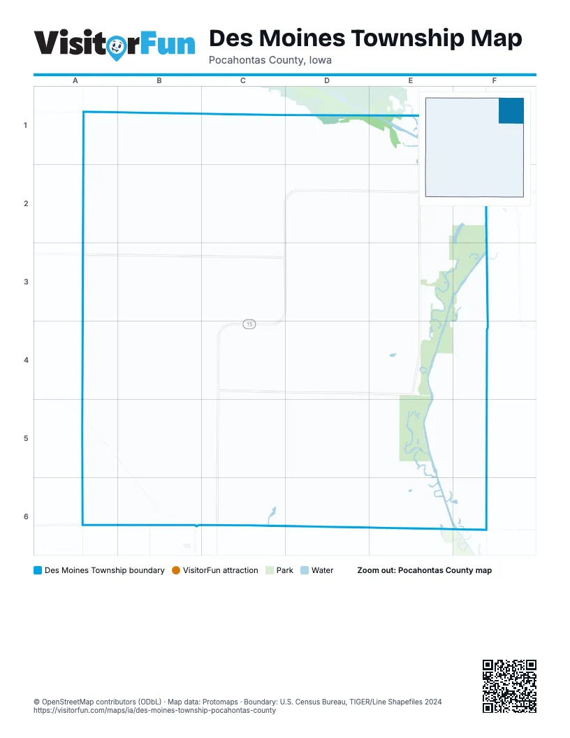
Street index of Des Moines Township
Each street on the sheet and the grid squares it crosses.
- 285th AvenueA1, A2
- 510th StreetA1, B1, C1
- 290th AvenueB1, B2, B3, B4, B5, B6
- 300th AvenueC1, C2, C3, C4, C5, C6
- 305th AvenueC1, C2
- 540th AvenueC1
- 320th AvenueD1, D2, D3, D4, D6
- 330th AvenueE1, E2, E3, E4
- 570th AvenueE1
- 410th StreetA2, B2, C2, D2, E2, F2
- 310th AvenueC2, D2, D3, D4, C5, D5, C6
- State Highway 15C2, D2, C3, D3, C4
- 280th AvenueA3, A4, A5, A6
- 420th StreetA3, B3, C3, D3, E3
- 430th StreetA4, B4, C4, D4, E4
- 440th StreetB4, C4, D4, E4, F4
- 325th AvenueE4, E5, E6
- Arizona AvenueF4, F5, F6
- 450th StreetA5, B5, C5, D5, E5
- 460th StreetA6, B6, D6, E6
- 465th StreetA6
- 457th StreetE6
Places on the map
- Des Moines Township
- Hams Wildlife Area
- Miller's Wildlife Area
- Old Rolfe Cemetery
- Schlensig Wildlife Area
- Stoddard Wildlife Area
- Struthers Wildlife Area
© OpenStreetMap contributors (ODbL) · Map data: Protomaps · Boundary: U.S. Census Bureau, TIGER/Line Shapefiles 2024