

Iowa map
Lakes and Land map
The sheet's index lists 8 highways; I-35, US 20 and IA 60 cross the most grid squares. Things to do inside the boundary: Arnolds Park Amusement Park, Beeds Lake State Park and Black Hawk State Park. Also on it: Algona, Belmond and Britt.
Open the map (PDF, US Letter)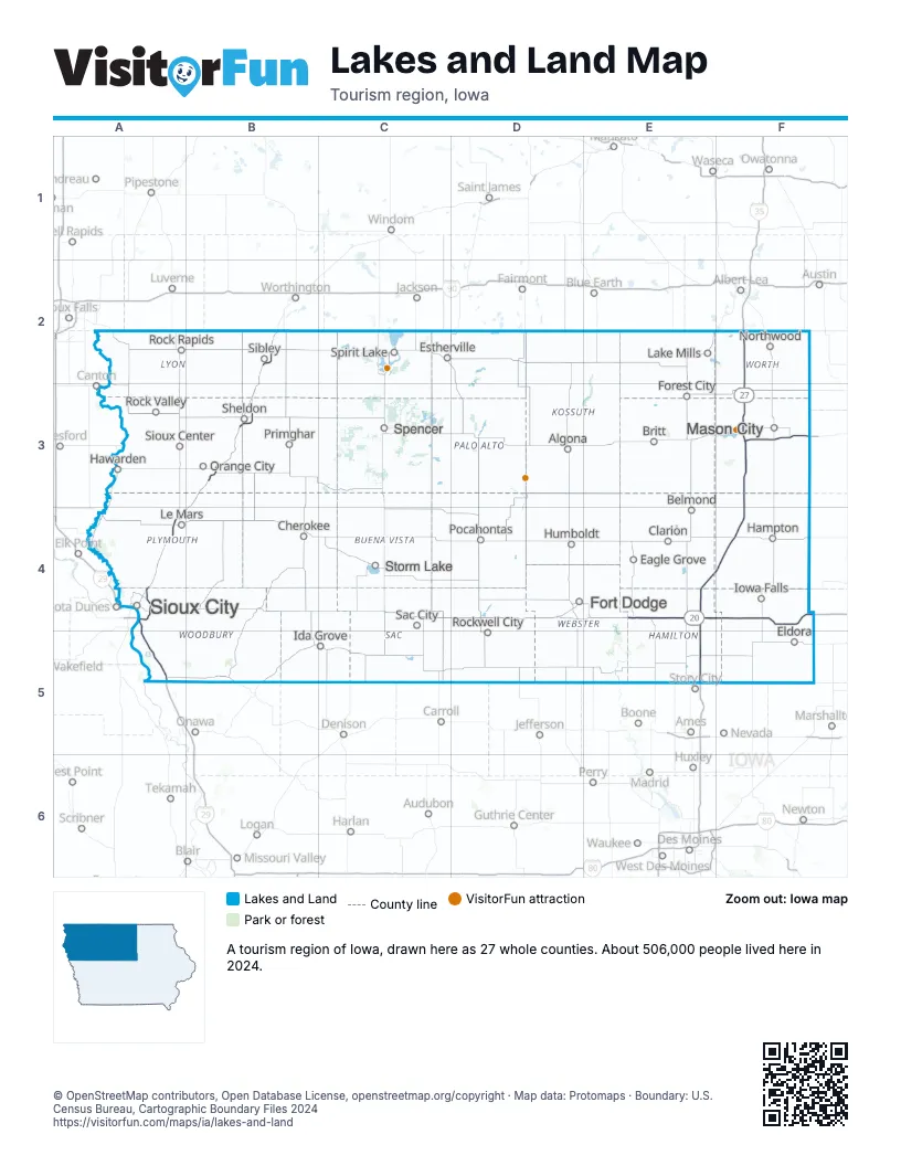
Highway index of Lakes and Land
Each highway on the sheet and the grid squares it crosses.
- I-29A4, A5
- I-35E4, E5, F2, F3, F4
- I-129A4
- US 18F3
- US 20A4, E4, F4
- US 75A4
- IA 27F2, F3
- IA 60A4, B2, B3
Things to do on the Lakes and Land map
Places on the map
- Algona
- Belmond
- Britt
- Cherokee
- Clarion
- Eagle Grove
- Eldora
- Estherville
- Forest City
- Fort Dodge
- Hampton
- Hawarden
- Humboldt
- Ida Grove
- Iowa Falls
- Lake Mills
- Le Mars
- Mason City
- Northwood
- Orange City
- Pocahontas
- Primghar
- Rock Rapids
- Rock Valley
- Rockwell City
- Sac City
- Sheldon
- Sibley
- Sioux Center
- Sioux City
- Spencer
- Spirit Lake
- Storm Lake
Next to Lakes and Land
- Capital Country map
- Driftless Area map
- Loess Hills and Beyond map
- Southern Minnesota
- Northeast Nebraska
- Southeast South Dakota
© OpenStreetMap contributors, Open Database License, openstreetmap.org/copyright · Map data: Protomaps · Boundary: U.S. Census Bureau, Cartographic Boundary Files 2024