

Iowa map
Iowa Township map
About 76,710 people live here (Census Bureau, 2024 estimate). The sheet's index lists 29 streets; Holy Cross Road, Girl Scout Road and Gun Club Road cross the most grid squares. Also on it: Bankston, Bankston Park and Dubuque County Law Enforcement Shooting Range.
Open the map (PDF, US Letter)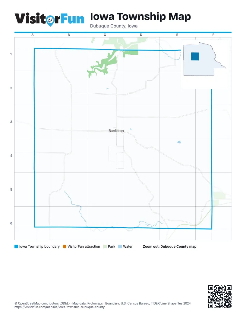
Street index of Iowa Township
Each street on the sheet and the grid squares it crosses.
- Tom Lucas RoadA1, B1, C1
- Holy Cross RoadB1, B2, B3, B4, A5, B5, A6
- Bankston Park RoadC1, D1, C2, C3
- Hannan RoadE1, E2, F2, F3
- North Bankston RoadE1, A2, B2, C2, D2
- Park Hollow RoadE1, F1
- Silver Creek LaneA2, A3
- Duggan LaneB2
- Heiderscheit LaneC2
- Root LaneE2, E3
- New Vienna RoadA3, B3, C3
- Wente RoadA3
- Tivoli LaneB3
- Asbury RoadC3, D3, E3, F3
- Girl Scout RoadC3, D3, D4, E4, F4, F5
- Gun Club RoadC3, D3, D4, D5, D6, E6
- Jewitt RoadC3, C4
- Thielen RoadE3, E4, F4
- Springdale RoadF3
- Dyersville East RoadA4, B4, C4, D4
- Heisler RoadB4, B5, A6, B6
- Seymour LaneD4
- Dry Hollow RoadB5, B6, C6, D6
- Olde School LaneB5, C5
- Mary LaneD5, E5, E6
- Kenkel LaneF5
- Millville RoadF5, D6, E6, F6
- Prier RoadA6
- Fishpond RoadD6
Places on the map
- Bankston
- Bankston Park
- Dubuque County Law Enforcement Shooting Range
- Law Enforcement Shooting Range
- McGee Cemetery
- Saint Clement Catholic Cemetery
- St Clement Catholic Church
- Tivoli Cemetery
© OpenStreetMap contributors, Open Database License, openstreetmap.org/copyright · Map data: Protomaps · Boundary: U.S. Census Bureau, TIGER/Line Shapefiles 2024