

Iowa map
Iowa Township map
About 76,710 people live here (Census Bureau, 2024 estimate). The sheet's index lists 46 streets; 500th Avenue, 550th Avenue and State Highway 64 cross the most grid squares. Also on it: Big Soup Bone Island, Canada Hollow Cemetery and Densmore Lake.
Open the map (PDF, US Letter)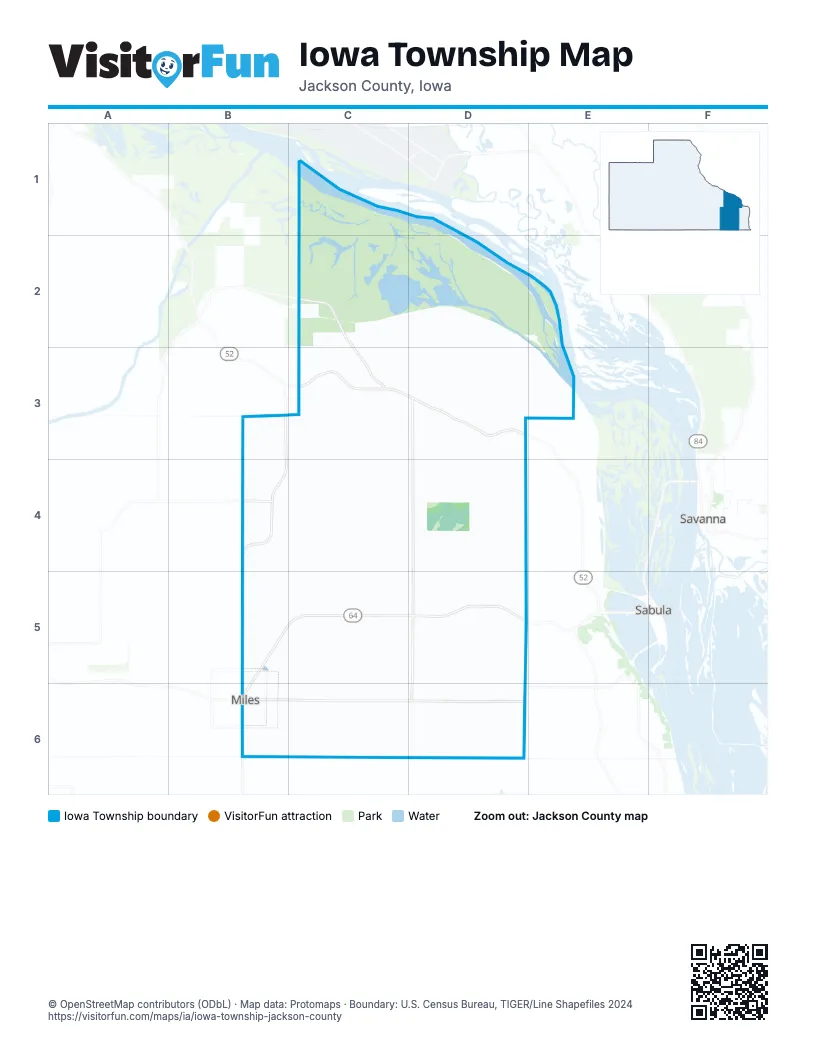
Street index of Iowa Township
Each street on the sheet and the grid squares it crosses.
- Green Island RoadC2, C3
- 500th AvenueB3, B4, B5, B6
- 87th StreetB3, C3, C4
- 540th AvenueC3, C4
- Great River RoadC3, D3
- 113th StreetD3
- 550th AvenueD3, D4, D5, D6
- 558th AvenueD3
- 576th AvenueD3
- 580th AvenueD3, D4
- 495th AvenueB4
- 64th StreetB4, C4, D4
- 75th StreetB4
- 525th AvenueC4, C5, C6
- 83rd StreetC4, D4
- 584th AvenueD4, D5
- 33rd StreetB5
- 45th StreetB5, C5
- 51st StreetB5
- Ferry RoadB5, B6
- State Highway 64B5, C5, D5, B6
- 50th StreetC5, D5
- 535th AvenueC5, C6
- 559th AvenueD5, D6
- 17th StreetB6, C6, D6
- Adams AvenueB6
- Allen StreetB6
- Centennial StreetB6
- Country RoadB6
- Forrest StreetB6
- Grant StreetB6
- Harrison StreetB6
- Hillcrest RoadB6
- Hoover StreetB6
- Kennedy StreetB6
- Lincoln StreetB6
- Luett RoadB6
- Orson StreetB6
- Prairie DriveB6
- Section RoadB6
- Sunset DriveB6
- Washington StreetB6
- Wilson StreetB6
- 100th StreetC6
- 545th AvenueC6
- 578th AvenueD6
Places on the map
- Big Soup Bone Island
- Canada Hollow Cemetery
- Densmore Lake
- Dickinson Cemetery
- Easton Valley Elementary School
- Fairview Cemetery
- Food Plot
- Great River Threshers Grounds
- Green Island Wildlife Management Area
- Horst Farm Cemetery
- Little Sawmill Lake
- Little Soup Bone Island
- Methodist Church
- Miles
- Miles Cemetery
- Miles Fire Station
- Miles Park
- Miles Post Office
- Miller Field
- Papke Wildlife Area
- Pinoak Lake
- Presbyterian Church
- Schroeder Farm Cemetery
- Smith Creek School
- Sterling Cemetery
- Upper Brown Lake
Next to Iowa Township
- Sabula
- Savanna
© OpenStreetMap contributors, Open Database License, openstreetmap.org/copyright · Map data: Protomaps · Boundary: U.S. Census Bureau, TIGER/Line Shapefiles 2024