

Iowa map
Jefferson County map
About 15,781 people live here (Census Bureau, 2024 estimate). The sheet's index lists 56 streets; State Highway 1, Pleasant Plain Road and Glasgow Road cross the most grid squares. Also on it: Batavia, Black Hawk Township and Bonnifield Lake.
Open the map (PDF, US Letter)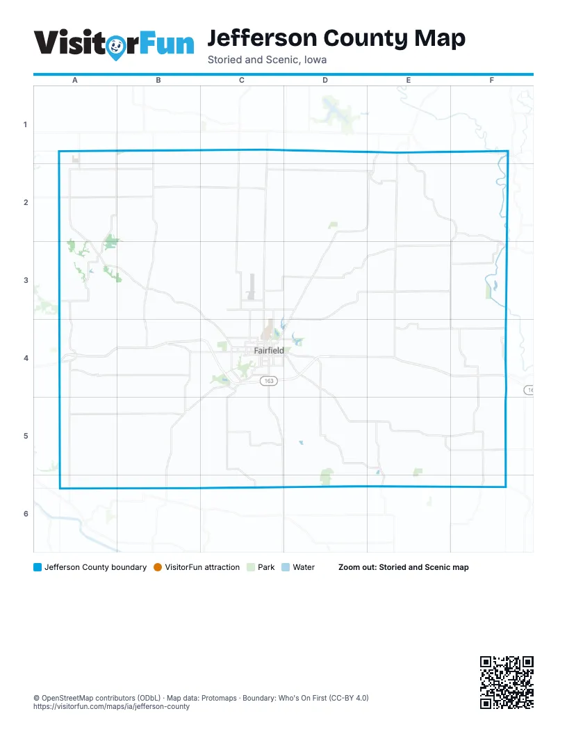
Maps inside Jefferson County
1 map inside, from the street map of Jefferson County down.
Street index of Jefferson County
Each street on the sheet and the grid squares it crosses.
- 270th AvenueB1
- Packwood RoadB1, B2, B3, B4
- State Highway 1C1, C2, C3, C4, C5, C6
- Ginkgo AvenueE1
- Pleasant Plain RoadE1, D2, E2, D3, C4
- Spruce AvenueE1, E2, E3, E4
- State Highway 78E1, F1
- Washington-Jefferson StreetE1, F1
- 125th StreetA2, B2
- 165th StreetA2
- 120th StreetB2, C2
- 4th StreetB2, A4
- Church StreetB2
- 110th StreetC2, D2, E2
- 115th StreetE2
- 116th BoulevardE2
- East Pleasant Plain RoadE2
- Penn StreetE2
- Raspberry AvenueE2
- 146th BoulevardF2, F3
- Germanville RoadF2, F3
- Brookville RoadB3, C3, C4
- Salina RoadD3, E3, F3, D4
- County Highway H28E3, F3
- Merrimac RoadF3
- Vetch BoulevardF3, F4
- Ash AvenueA4, A5, A6
- Hemlock AvenueB4, B5
- Old US 34B4, C4
- East Burlington AvenueC4, D4
- East Kirkwood AvenueC4
- Glasgow RoadC4, D4, D5, E5, F5
- Libertyville RoadC4, B5
- North 28th StreetC4
- North 2nd StreetC4
- North 4th StreetC4
- North 9th StreetC4
- South 32nd StreetC4
- South Main StreetC4, B5
- West Burlington AvenueC4
- West Gear AvenueC4
- West Grimes AvenueC4
- West Kirkwood AvenueC4
- West Merrill AvenueC4
- 195th StreetF4
- South Center StreetF4
- West Main StreetF4
- Wintergreen BoulevardF4, F5
- 240th StreetA5, B5
- Douds RoadB5, B6
- Fairfield RoadB5
- North Main StreetB5
- West Maple AvenueB5
- Stockport RoadE5, E6
- County Highway V64B6
- Route W30E6
Places on the map
- Batavia
- Black Hawk Township
- Bonnifield Lake
- Buchanan Township
- Cedar Township
- Cedar View Timber & Wetland
- Center Township
- Chautauqua Park
- Des Moines Township
- Fairfield
- Fairfield Municipal Airport
- Gantz-Hewett Timber
- Horse Shoe Lake
- Jefferson County
- Jefferson County Health Center
- Jefferson County Park
- Lamson Woods State Preserve
- Liberty Township
- Libertyville
- Lockridge
- Lockridge Township
- Locust Grove Township
- Mac Coon County Park
- Maharishi Vedic City
- Packwood
- Pekin Community School
- Penn Township
- Pleasant Plain
- Polk Township
- Reservoir Number Two
- Round Prairie Park
- Round Prairie Township
- Skunk River
- Timber Lake
- Turkey Run Wildlife Area
- Walnut Township
- Walton Golf Club
- Walton Lake
- Waterworks Park
- Whitham Woods Park
© OpenStreetMap contributors (ODbL) · Map data: Protomaps · Boundary: Who's On First (CC-BY 4.0)