

Iowa map
Linn County map
About 231,762 people live here (Census Bureau, 2024 estimate). The sheet's index lists 5 streets; Avenue of the Saints, Collins Road Northeast and Juhl Drive Northeast cross the most grid squares. Things to do inside the boundary: National Czech & Slovak Museum & Library.
Open the map (PDF, US Letter)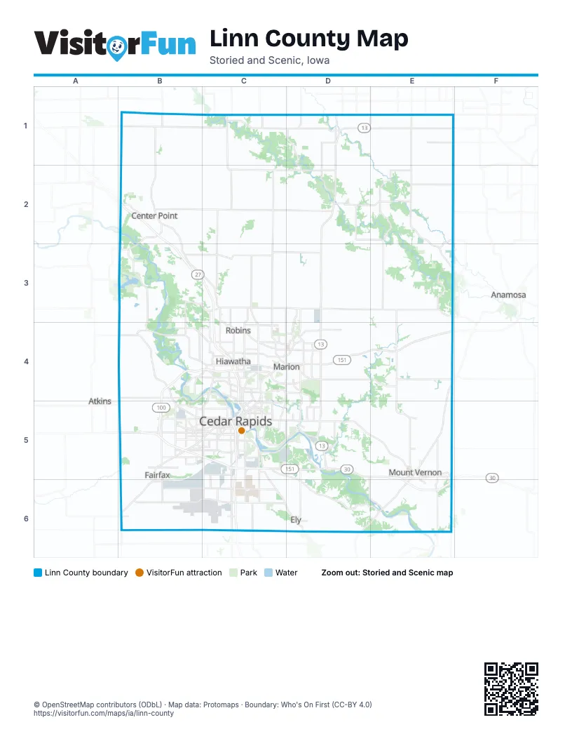
Street index of Linn County
Each street on the sheet and the grid squares it crosses.
- Avenue of the SaintsB2, B3, C3, C4, C5, C6
- Collins Road NortheastC4
- Juhl Drive NortheastC4
- 16th Avenue SouthwestB5
- Lincoln FreewayC5
Things to do on the Linn County map
Places on the map
- ADM
- Alburnett
- Applewood Hills
- Applewood Mesa
- Bannockburn Estates
- Bel Air Estates
- Bertram
- Bertram Township
- Bever Park
- Big Cedar Industrial Center
- Big Lewis Lake
- Bird Preserve
- Blackford
- Boulder Township
- Bowman Meadows
- Bowman Ridge East
- Bowman Woods
- Brown Township
- Buffalo Creek County Park
- Buffalo Township
- C. J. Moyna & Sons
- Camp Wakonda
- Cedar Hills
- Cedar Hills Hilltop
- Cedar Lake
- Cedar Lake Park
- Cedar Rapids
- Cedar Rapids Country Club
- Cedar Rapids South Quarry
- Cedarcrest Heights
- Center Point
- Central City
- Chain Lakes Natural Area
- Chestnut Valley
- Cheyenne Park
- Clinton Township
- Coggon
- College Township
- Cottage Hill
- Country Club Estates
Next to Linn County
- Anamosa
- Atkins
© OpenStreetMap contributors (ODbL) · Map data: Protomaps · Boundary: Who's On First (CC-BY 4.0)