

Indiana map
North Central Indiana map
The sheet's index lists 11 highways; US 31, US 20 and US 30 cross the most grid squares. Things to do inside the boundary: Bendix Woods County Park, Midwest Museum of American Art and Notre Dame Stadium. Also on it: Bremen, Elkhart and Goshen.
Open the map (PDF, US Letter)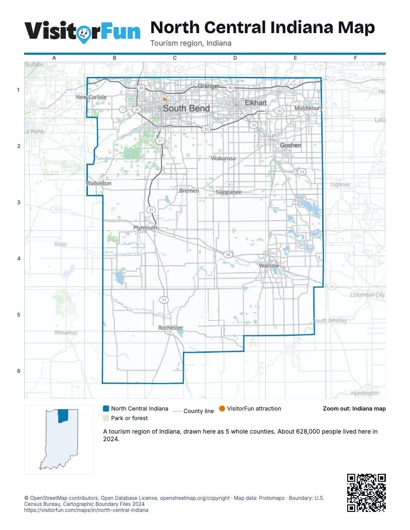
Highway index of North Central Indiana
Each highway on the sheet and the grid squares it crosses.
- I-80B1, C1, D1, E1
- I-90B1, C1, D1, E1
- US 6E3
- US 20B1, C2, D1, D2, E1
- US 30B3, C3, C4, D4, E4
- US 31B1, C2, C3, C4, C5, C6
- US 33D1, D2, E2, E3
- US 131E1
- SR 2B1
- SR 13E3
- SR 331C1, C2
Things to do on the North Central Indiana map
Places on the map
- Bremen
- Elkhart
- Goshen
- Granger
- Middlebury
- Nappanee
- New Carlisle
- Plymouth
- Rochester
- South Bend
- Wakarusa
- Walkerton
- Warsaw
Next to North Central Indiana
- Northeast Indiana map
- Northwest Indiana map
- Wabash Valley map
- Southwest Lower Peninsula
© OpenStreetMap contributors, Open Database License, openstreetmap.org/copyright · Map data: Protomaps · Boundary: U.S. Census Bureau, Cartographic Boundary Files 2024