

Indiana map
Northeast Indiana map
The sheet's index lists 18 highways; I-69, US 33 and US 24 cross the most grid squares. Things to do inside the boundary: Auburn Cord Duesenberg Automobile Museum, Chain O' Lakes State Park and Fort Wayne Museum of Art. Also on it: Angola, Auburn and Berne.
Open the map (PDF, US Letter)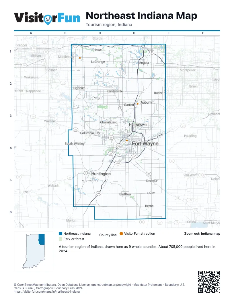
Highway index of Northeast Indiana
Each highway on the sheet and the grid squares it crosses.
- I-69C4, C5, C6, D1, D2, D3, D4
- I-80B1, C1, D1, E1
- I-90B1, C1, D1, E1
- I-469C4, D3, D4
- US 6B2, C2, D2, E2
- US 24B5, C4, C5, D3, D4, E4
- US 27D4, D5, D6
- US 30B3, C3, C4, D3, D4, E4
- US 33B2, C2, C3, C4, D4, D5, E5
- US 224D5
- SR 3C2, D2, D3, D4
- SR 5B2
- SR 8C2, D2, D3
- SR 9B5, B6, C2, C5
- SR 101E5
- SR 105B5
- SR 327D2
- SR 930D4
Things to do on the Northeast Indiana map
Places on the map
- Angola
- Auburn
- Berne
- Bluffton
- Butler
- Churubusco
- Columbia City
- Decatur
- Fort Wayne
- Garrett
- Howe
- Huntertown
- Huntington
- Kendallville
- LaGrange
- Ligonier
- South Whitley
Next to Northeast Indiana
- East Central Indiana map
- North Central Indiana map
- Wabash Valley map
- Southeast Lower Peninsula
- Southwest Lower Peninsula
- Northwest Ohio
© OpenStreetMap contributors, Open Database License, openstreetmap.org/copyright · Map data: Protomaps · Boundary: U.S. Census Bureau, Cartographic Boundary Files 2024