

Kansas map
Southwest Kansas map
The sheet's index lists 11 highways; US 50, US 400 and US 54 cross the most grid squares. Things to do inside the boundary: Boot Hill Museum and Fort Larned National Historic Site. Also on it: Ashland, Cimarron and Coldwater.
Open the map (PDF, US Letter)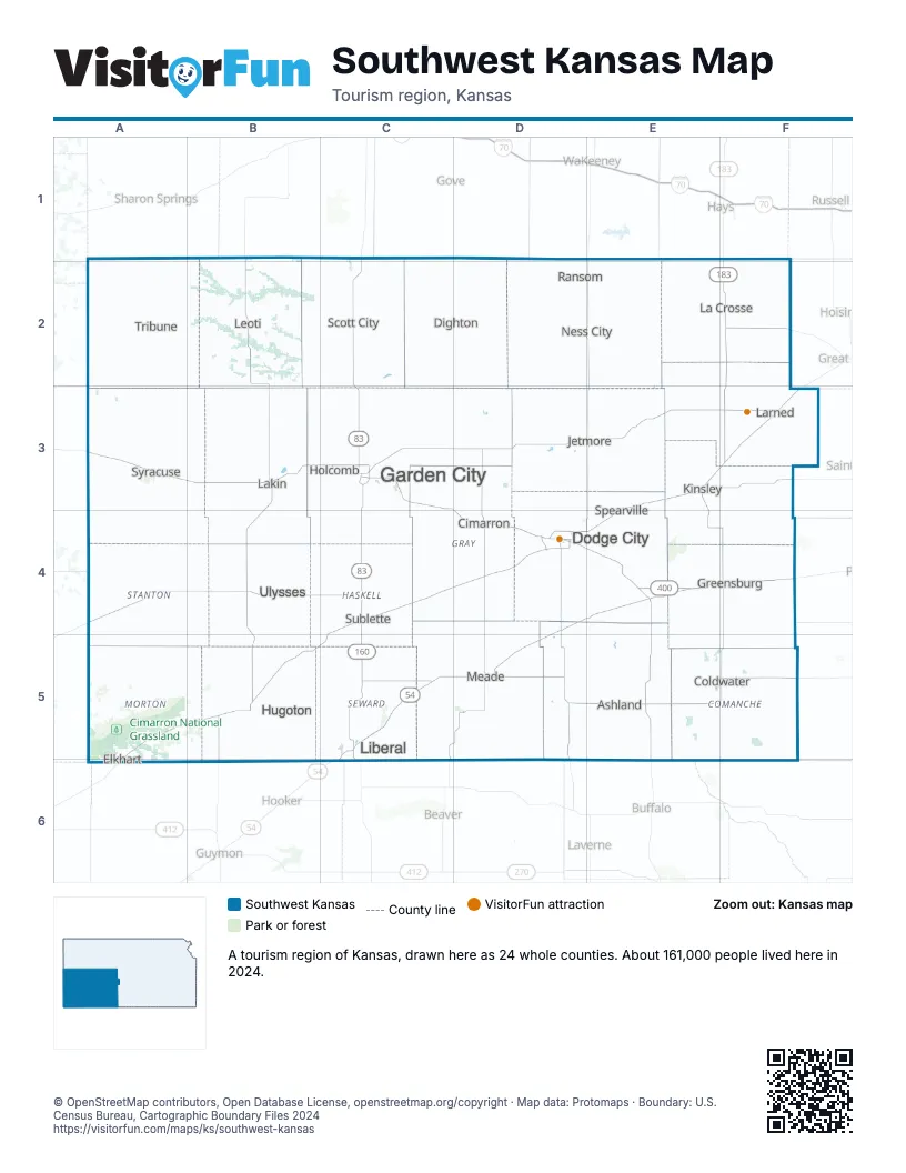
Highway index of Southwest Kansas
Each highway on the sheet and the grid squares it crosses.
- US 50A3, B3, C3, D3, D4, E3, E4, F3
- US 54C5, C6, D4, D5, E4, F4
- US 56D4, E3, E4, F3
- US 83C2, C3, C4, C5
- US 160C4, C5, D5
- US 183E3, F1, F2, F3
- US 283D4, E4
- US 400A3, B3, C3, D3, D4, E4, F4
- KS 27A3
- KS 96F2
- KS 156F3
Things to do on the Southwest Kansas map
Places on the map
- Ashland
- Cimarron
- Coldwater
- Dighton
- Dodge City
- Elkhart
- Garden City
- Greensburg
- Holcomb
- Hugoton
- Jetmore
- Kinsley
- La Crosse
- Lakin
- Larned
- Leoti
- Liberal
- Meade
- Ness City
- Ransom
- Scott City
- Spearville
- Sublette
- Syracuse
- Tribune
- Ulysses
Next to Southwest Kansas
- Canyons & Plains
- Pioneering Plains
- North Central Kansas map
- Northwest Kansas map
- South Central Kansas map
- Red Carpet Country
© OpenStreetMap contributors, Open Database License, openstreetmap.org/copyright · Map data: Protomaps · Boundary: U.S. Census Bureau, Cartographic Boundary Files 2024