

Kansas map
South Central Kansas map
The sheet's index lists 15 highways; I-35, US 50 and KS 96 cross the most grid squares. Things to do inside the boundary: Botanica, The Wichita Gardens, Cosmosphere and Exploration Place. Also on it: Anthony, Arkansas City and Caldwell.
Open the map (PDF, US Letter)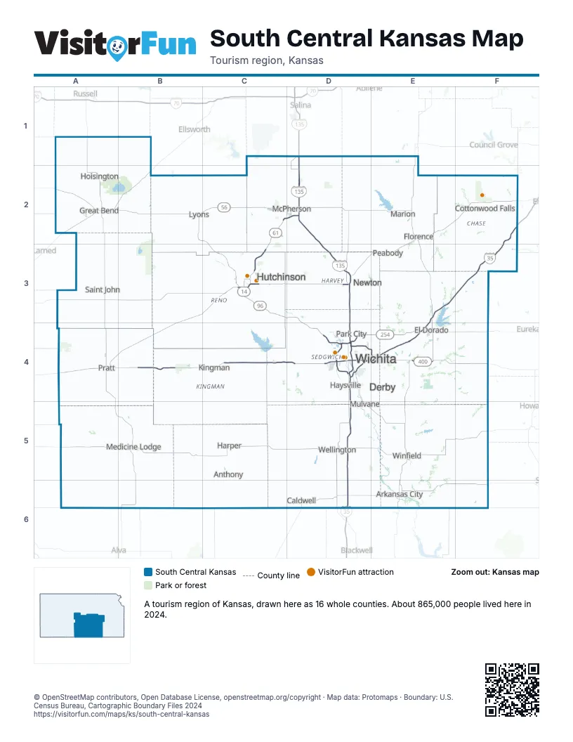
Highway index of South Central Kansas
Each highway on the sheet and the grid squares it crosses.
- I-35D4, D5, D6, E3, E4, F2, F3
- I-135D2, D3, D4
- I-235D4
- US 50A3, B3, C3, D3, E2, E3, F2
- US 54A4, B4, C4, D4, E4, F4
- US 56A2, B2, C2, D2
- US 77E4
- US 81D2, D3, D4
- US 400A4, B4, C4, D4, E4, F4
- KS 14B2, C2, C3, C4
- KS 15D3, D4
- KS 61A4, B3, B4, C2, C3, D2
- KS 96A2, B2, C2, C3, D3, D4, E4
- KS 156A2
- KS 254D4, E4
Things to do on the South Central Kansas map
- Botanica, The Wichita Gardens
- Cosmosphere
- Exploration Place
- Kansas Motorcycle Museum
- Kansas Star Casino
- Keeper of the Plains
- Mid-America All-Indian Museum
- Museum of World Treasures
- Old Cowtown Museum
- Sedgwick County Zoo
- Strataca
- Tallgrass Prairie National Preserve
- Wichita Art Museum
- Wichita-Sedgwick County Historical Museum
Places on the map
- Anthony
- Arkansas City
- Caldwell
- Cottonwood Falls
- Derby
- El Dorado
- Florence
- Great Bend
- Harper
- Haysville
- Hoisington
- Hutchinson
- Kingman
- Lyons
- Marion
- McPherson
- Medicine Lodge
- Mulvane
- Newton
- Park City
- Peabody
- Pratt
- Saint John
- Wellington
- Wichita
- Winfield
Next to South Central Kansas
- North Central Kansas map
- Southeast Kansas map
- Southwest Kansas map
- Green Country
- Red Carpet Country
© OpenStreetMap contributors, Open Database License, openstreetmap.org/copyright · Map data: Protomaps · Boundary: U.S. Census Bureau, Cartographic Boundary Files 2024