

Maryland map
Baltimore County map
About 852,425 people live here (Census Bureau, 2024 estimate). The sheet's index lists 11 streets; Baltimore Beltway, Baltimore-Harrisburg Expressway and Express Toll Lanes cross the most grid squares. Things to do inside the boundary: Conrad's Seafood Restaurant.
Open the map (PDF, US Letter)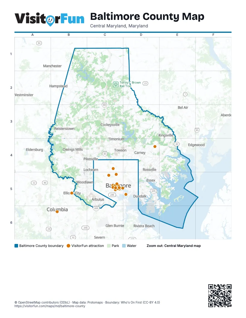
Street index of Baltimore County
Each street on the sheet and the grid squares it crosses.
- Baltimore-Harrisburg ExpresswayC1, C2, C3, C4
- Northwest ExpresswayB3, B4
- Baltimore BeltwayB4, C4, D4, B5, C5, D5
- Jones Falls ExpresswayC4
- Express Toll LanesD4, E4, D5
- John F. Kennedy Memorial HighwayD4, E4, D5
- White Marsh BoulevardD4
- Baltimore-Washington ParkwayC5
- Harbor Tunnel ThruwayC5, D5, C6
- Metropolitan BoulevardC5, C6
- Southeast FreewayD5
Things to do on the Baltimore County map
Places on the map
- A Yard
- Academy Acres
- Agricultural Loop Trail
- All Saints Sisters of the Poor
- Anneslie
- Anton North
- Apple Valley
- Arbutus
- Avalon
- Back River
- Ballard Green
- Baltimore Country Club
- Baltimore Crossroads @ 95
- Batavia Park
- Bayview Yard
- Beaver Dam Run
- Beaverbrook
- Beaverdam Run
- BeeTree Preserve
- Beetree Run
- Belle Farm Estates
- Bentley Estates
- Beth Tfiloh Camps
- Bird River
- Black Marsh
- Blue Mount Materials
- Bonnie Ridge
- Boordy Vineyards
- Bosley Farm
- Bowleys Quarters
- Boxer Hill Park
- Briar Knoll
- Brice Run
- Bridle Ridge
- Bridleshire
- Brightside
- Broadmoor
- Broadridge
- Brookview Farms
Next to Baltimore County
- Aberdeen
- Baltimore map
- Bel Air
- Brooklyn Park
- Columbia
- Edgewood
- Eldersburg
- Ellicott City
- Glen Burnie
- Hampstead
- Joppatowne
- Manchester
- Pasadena
- Riviera Beach
- Severn
- Westminster
© OpenStreetMap contributors (ODbL) · Map data: Protomaps · Boundary: Who's On First (CC-BY 4.0)