

Michigan road map
Michigan highway map
11 Interstate routes run about 1,217 miles in Michigan, each on a sheet of its own. The sheet's index lists 19 highways; I-75, I-94 and I-69 cross the most grid squares. Towns on it: Detroit, Grand Rapids and Ann Arbor.
Open the map (PDF, US Letter)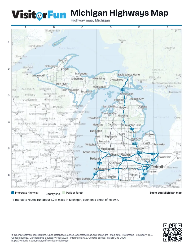
Road maps of Michigan
8 road maps: each Interstate and byway on a sheet of its own.
Highway index of Michigan
Each highway on the sheet and the grid squares it crosses.
- I-69D5, D6, E5, F5
- I-75D3, D4, E2, E3, E4, E5, E6
- I-94C6, D6, E5, E6, F5
- I-96D5, E5, E6
- I-194D6
- I-196D5, D6
- I-275E6
- I-375E6
- I-475E5
- I-496D5, E5
- I-675E5
- I-696E6
- US 10D4, D5, E5
- US 12E6
- US 23E4, E5, E6
- US 31C4, D4, D5, D6
- US 127D4, D5, E5, E6
- US 131D4, D5, D6
- US 223E6
Places on the map
- Adrian
- Alma
- Alpena
- Ann Arbor
- Bad Axe
- Bay City
- Big Rapids
- Cadillac
- Caro
- Charlotte
- Cheboygan
- Clare
- Detroit
- East Jordan
- Escanaba
- Frankenmuth
- Frankfort
- Fremont
- Gaylord
- Gladwin
- Grand Haven
- Grand Rapids
- Grayling
- Hancock
- Hart
- Holland
- Houghton Lake
- Iron Mountain
- Iron River
- Ironwood
- Ishpeming
- Kalamazoo
- L'Anse
- Ludington
- Manistee
- Manistique
- Marquette
- Morenci
- Munising
- Muskegon
- New Buffalo
- Newberry
- Niles
- Ontonagon
- Petoskey
- Pontiac
- Rogers City
- Saint Clair
- Sandusky
- Sault Sainte Marie
- Sturgis
- Traverse City
- Trenton
- Whitehall
© OpenStreetMap contributors, Open Database License, openstreetmap.org/copyright · Map data: Protomaps · Boundary: U.S. Census Bureau, Cartographic Boundary Files 2024 · Interstates: U.S. Census Bureau, TIGER/Line 2026