

Michigan road map
Woodward Avenue (M-1) - Automotive Heritage Trail map
The Woodward Avenue (M-1) - Automotive Heritage Trail has been an All-American Road since 2009, named for its cultural and historic qualities: about 25 miles in Michigan. It meets 9 highways, among them I-75, I-94 and I-696. Towns along it: Detroit, Troy and Southfield.
Open the map (PDF, US Letter)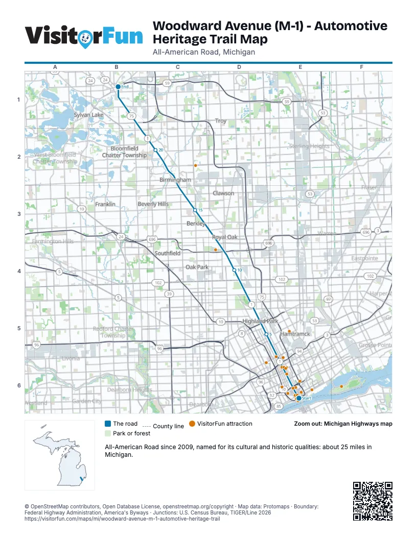
Highways it meets
Each highway it meets and the grid squares where they meet.
- US 12E6
- MI 3E6
- MI 1E6
- MI 5E6
- I-75E6
- I-94E6
- MI 8D5
- MI 102D4
- I-696D4
Towns along the Woodward Avenue (M-1) - Automotive Heritage Trail
In mile order, with the grid square of each.
- Detroitmile 0, E6
- Hamtramckmile 4, E5
- Highland Parkmile 5, D5
- Hazel Parkmile 9, D4
- Ferndalemile 9, D4
- Pleasant Ridgemile 11, D4
- Oak Parkmile 11, D4
- Royal Oakmile 11, D4
- Huntington Woodsmile 12, D4
- Berkleymile 13, D3
- Southfieldmile 15, C3
- Beverly Hillsmile 16, C3
- Troymile 16, C3
- Birminghammile 17, C3
- Bloomfield Hillsmile 19, C2
- Pontiacmile 23, B1
Things to do on the Woodward Avenue (M-1) - Automotive Heritage Trail map
- Detroit Princess Riverboat
- Detroit Riverwalk
- Campus Martius Park
- MotorCities National Heritage Area
- Hollywood Casino at Greektown
- Lafayette Greens
- MGM Grand Detroit
- Comerica Park
- Fox Theatre
- Eastern Market
- MotorCity Casino Hotel
- Museum of Contemporary Art Detroit
- Charles H. Wright Museum of African American History
- Michigan Science Center
- Detroit Institute of Arts
- Detroit Historical Museum
- Ford Piquette Avenue Plant
- Motown Museum
- Detroit Zoo
© OpenStreetMap contributors, Open Database License, openstreetmap.org/copyright · Map data: Protomaps · Boundary: Federal Highway Administration, America's Byways · Junctions: U.S. Census Bureau, TIGER/Line 2026