

Missouri map
Jefferson County map
About 231,888 people live here (Census Bureau, 2024 estimate). The sheet's index lists 4 streets; USMA Cadet Thomas M. Surdyke Memorial Highway, Jeff McBride Memorial Highway and Veterans Memorial Highway cross the most grid squares. Things to do inside the boundary: WOW Entertainment.
Open the map (PDF, US Letter)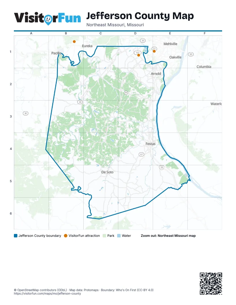
Street index of Jefferson County
Each street on the sheet and the grid squares it crosses.
- Veterans Memorial HighwayD1
- Jeff McBride Memorial HighwayD2, D3
- Police Officer Steven Jarvis Memorial HighwayE2
- USMA Cadet Thomas M. Surdyke Memorial HighwayD4, E4, E5
Things to do on the Jefferson County map
Places on the map
- Apple Valley Farm
- Arnold
- Arnold Rifle & Pistol Club
- Autumn Lake
- Barnhart
- Belews Creek
- Bellefontaine Quarry South
- Big River
- Big River Township
- Brennen's Glen
- Byrnes Mill
- Cape Town Village South
- Cedar Hill
- Cedar Hill Lakes
- Central Township
- Cole Lake
- Crystal City
- De Soto
- Don Robinson State Park
- Festus
- Fore Honor Golf Course
- Fox Run Golf Club
- Glavel Lakes
- Herculaneum
- High Ridge
- High Ridge Township
- Hillsboro
- Horine
- Huntington Glen
- Imperial
- Imperial Township
- Jefferson County
- Joachim Township
- Kimmswick
- LaBarque Hills Trail
- Lake Briarwood
- Lake Lorraine
- Lake Tishomingo
- Lake Wauwanoka
- Larry G. Crites Memorial Park
Next to Jefferson County
- Columbia
- Concord
- Eureka
- Mehlville
- Oakville
- Pacific
- Waterloo
© OpenStreetMap contributors (ODbL) · Map data: Protomaps · Boundary: Who's On First (CC-BY 4.0)