

North Carolina road map
Blue Ridge Parkway map
The Blue Ridge Parkway has been an All-American Road since 1996, named for its historic, scenic, recreational and cultural qualities: about 469 miles in North Carolina and Virginia. It meets 41 highways, among them I-26, I-40 and I-64. Towns along it: Roanoke, Asheville and Vinton.
Open the map (PDF, US Letter)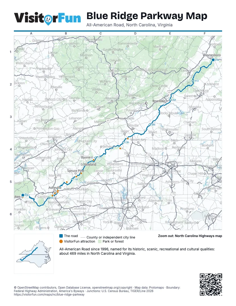
Highways it meets
Each highway it meets and the grid squares where they meet.
- US 19A5
- US 74A6
- US 23A6
- NC 215A6
- US 276A6
- NC 151A6
- NC 191B5
- I-26B5
- US 25B5
- I-40B5
- US 70B5
- NC 694B5
- NC 128B5
- NC 226B5
- US 221B5
- NC 183B5
- NC 181B5
- US 321C4
- US 421C4
- NC 16C4
- NC 163C4
- NC 18C4
- US 21D4
- VA 89D4
- VA 97D4
- I-77D4
- US 52D4
- US 58D3
- VA 8D3
- VA 709D3
- VA 642E3
- US 220E3
- VA 116E3
- VA 24E2
- US 460E2
- US 501F2
- VA 130F2
- US 60F2
- VA 56F1
- I-64F1
- US 250F1
Towns along the Blue Ridge Parkway
In mile order, with the grid square of each.
- Cherokeemile 0, A5
- Ashevillemile 68, B5
- Biltmore Forestmile 72, B5
- Linvillemile 150, C5
- Foscoemile 159, C4
- Blowing Rockmile 165, C4
- Fancy Gapmile 259, D4
- Meadows of Danmile 284, D3
- Cave Springmile 338, E3
- Roanokemile 343, E3
- Vintonmile 350, E3
- Laymantownmile 359, E2
- Blue Ridgemile 360, E2
- Wintergreenmile 454, F1
- Nellysfordmile 460, F1
- Sherandomile 463, F1
- Aftonmile 469, F1
Things to do on the Blue Ridge Parkway map
© OpenStreetMap contributors, Open Database License, openstreetmap.org/copyright · Map data: Protomaps · Boundary: Federal Highway Administration, America's Byways · Junctions: U.S. Census Bureau, TIGER/Line 2026