

Nebraska map
Omaha Metro Area map
The sheet's index lists 13 highways; I-80, I-29 and US 30 cross the most grid squares. Things to do inside the boundary: Bob Kerrey Pedestrian Bridge, Gene Leahy Mall and Great Plains Black History Museum. Also on it: Ashland, Bellevue and Bennington.
Open the map (PDF, US Letter)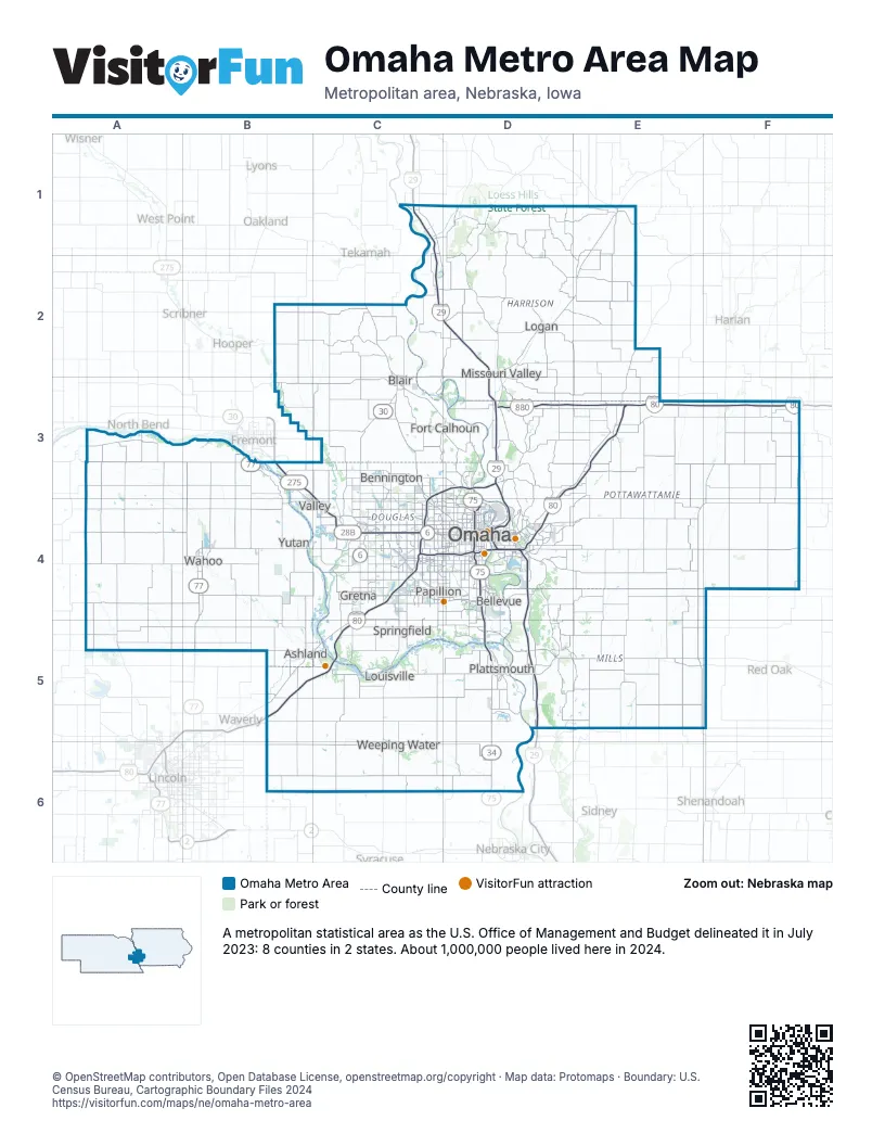
Highway index of Omaha Metro Area
Each highway on the sheet and the grid squares it crosses.
- I-29C1, C2, D2, D3, D4, D5
- I-80B5, C4, C5, D3, D4, E3, F3
- I-480D4
- I-680C3, C4, D3
- I-880D3, E3
- US 6C4, C5, D4
- US 6RD4
- US 30B3, C2, C3, D2, D3
- US 34D5, D6
- US 75C3, D3, D4, D5, D6
- US 77B3, B4, B5
- US 275B3, C3, C4, D4, D5
- IA 165D4
Things to do on the Omaha Metro Area map
- Bob Kerrey Pedestrian Bridge
- Gene Leahy Mall
- Great Plains Black History Museum
- Hall of History
- Joslyn Art Museum
- Kiewit Luminarium
- Lee G. Simmons Wildlife Safari Park
- Malcolm X House Site
- Mormon Trail Center at Winter Quarters
- Old Market
- Omaha Children's Museum
- Omaha's Henry Doorly Zoo and Aquarium
- Ruth Sokolof Theater
- Shadow Lake Towne Center
- Strategic Air Command & Aerospace Museum
- The Durham Museum
- The Lincoln Highway at Elkhorn
- Westroads Mall
Places on the map
- Ashland
- Bellevue
- Bennington
- Blair
- Fort Calhoun
- Gretna
- Logan
- Louisville
- Missouri Valley
- Omaha
- Papillion
- Plattsmouth
- Springfield
- Valley
- Wahoo
- Weeping Water
- Yutan
© OpenStreetMap contributors, Open Database License, openstreetmap.org/copyright · Map data: Protomaps · Boundary: U.S. Census Bureau, Cartographic Boundary Files 2024