

New Jersey road map
Bayshore Heritage Byway map
The Bayshore Heritage Byway has been a National Scenic Byway since 2021, named for its natural qualities: about 125 miles in New Jersey. It meets 6 highways, among them US 9, NJ 45 and NJ 47. Towns along it: Bridgeton, Pennsville and Salem.
Open the map (PDF, US Letter)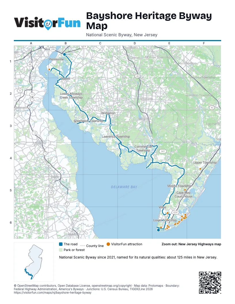
Highways it meets
Each highway it meets and the grid squares where they meet.
- US 9E6
- NJ 47E5
- NJ 83E4
- NJ 347E4
- NJ 49B2
- NJ 45B1
Towns along the Bayshore Heritage Byway
In mile order, with the grid square of each.
- Cape May Pointmile 0, E6
- West Cape Maymile 1, E6
- Cape Maymile 2, E6
- Ermamile 6, E6
- Villasmile 8, E6
- North Cape Maymile 9, E6
- Whitesboromile 13, E5
- Goshenmile 20, E5
- South Dennismile 24, E4
- Dennisvillemile 25, E4
- Woodbinemile 26, E4
- Delmontmile 33, E4
- Heislervillemile 36, E4
- Port Norrismile 38, E4
- Leesburgmile 38, E4
- Dorchestermile 40, E4
- Mauricetownmile 42, D4
- Dividing Creekmile 50, D4
- Newportmile 54, D4
- Cedarvillemile 59, C3
- Fairtonmile 62, C3
- Gouldtownmile 65, C3
- Bridgetonmile 65, C3
- Dutch Neckmile 70, C3
- Othellomile 73, C3
- Greenwichmile 73, C3
- Salemmile 91, B2
- Pennsvillemile 101, B1
- Fortescuemile 115, D4
Things to do on the Bayshore Heritage Byway map
© OpenStreetMap contributors, Open Database License, openstreetmap.org/copyright · Map data: Protomaps · Boundary: Federal Highway Administration, America's Byways · Junctions: U.S. Census Bureau, TIGER/Line 2026















