

New Mexico road map
Santa Fe Trail map
The Santa Fe Trail has been a National Scenic Byway since 1998, named for its historic qualities: about 563 miles in New Mexico and Colorado. It meets 40 highways, among them I-25, US 50 and US 56. Towns along it: Santa Fe, Las Vegas and Trinidad.
Open the map (PDF, US Letter)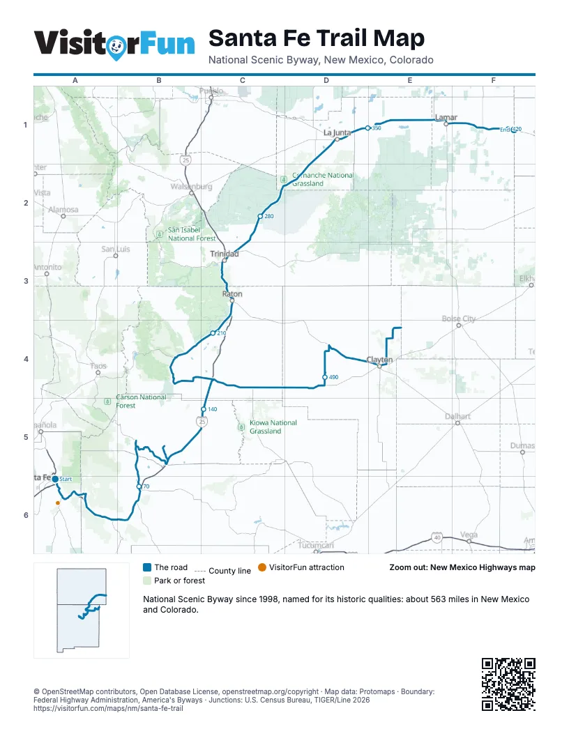
Highways it meets
Each highway it meets and the grid squares where they meet.
- NM 300A6
- US 285A6
- I-25A6
- US 84A6
- US 85A6
- NM 50A6
- NM 63A6
- NM 3A6
- NM 283B6
- NM 329B6
- NM 518B6
- NM 266B5
- NM 161B5
- NM 120B5
- NM 569C4
- NM 21C4
- US 64B4
- NM 505B4
- NM 445C4
- NM 555C3
- US 87C3
- US 160C3
- US 350C3
- CO 71D1
- US 50D1
- CO 109D1
- CO 196E1
- US 287E1
- US 385F1
- CO 89F1
- NM 18E4
- NM 410E4
- NM 406E4
- NM 411E4
- US 56E4
- NM 538E4
- NM 370E4
- NM 453D4
- NM 193C4
- NM 39C4
Towns along the Santa Fe Trail
In mile order, with the grid square of each.
- Santa Femile 0, A6
- Santa Fe Foothillsmile 3, A6
- Conejomile 3, A6
- Arroyo Hondomile 4, A6
- Sunlit Hillsmile 5, A6
- Eldorado at Santa Femile 10, A6
- Cañoncitomile 10, A6
- Valenciamile 16, A6
- Glorietamile 18, A6
- La Cuevamile 19, A6
- Pecosmile 23, A6
- East Pecosmile 24, A6
- Rowemile 27, A6
- Sohammile 41, A6
- Riberamile 45, A6
- Tecolotemile 55, B6
- Las Vegasmile 65, B6
- Watrousmile 106, B5
- Wagon Moundmile 128, B5
- Springermile 153, C4
- Cimarronmile 187, B4
- Ratonmile 227, C3
- Trinidadmile 248, C3
- El Moromile 254, C3
- La Juntamile 333, D1
- La Junta Gardensmile 334, D1
- North La Juntamile 335, D1
- Las Animasmile 353, E1
- Hastymile 369, E1
- McClavemile 375, E1
- Lamarmile 389, E1
- Granadamile 407, F1
- Hollymile 418, F1
- Claytonmile 446, E4
- Grenvillemile 563, D4
Things to do on the Santa Fe Trail map
© OpenStreetMap contributors, Open Database License, openstreetmap.org/copyright · Map data: Protomaps · Boundary: Federal Highway Administration, America's Byways · Junctions: U.S. Census Bureau, TIGER/Line 2026