

New York map
Boerum Hill map
A printable two-page map of Boerum Hill (Brooklyn, New York), drawn by VisitorFun from OpenStreetMap. Page two is the street index: every street on the sheet with its grid square, the same list as below.
Open the map (PDF, US Letter)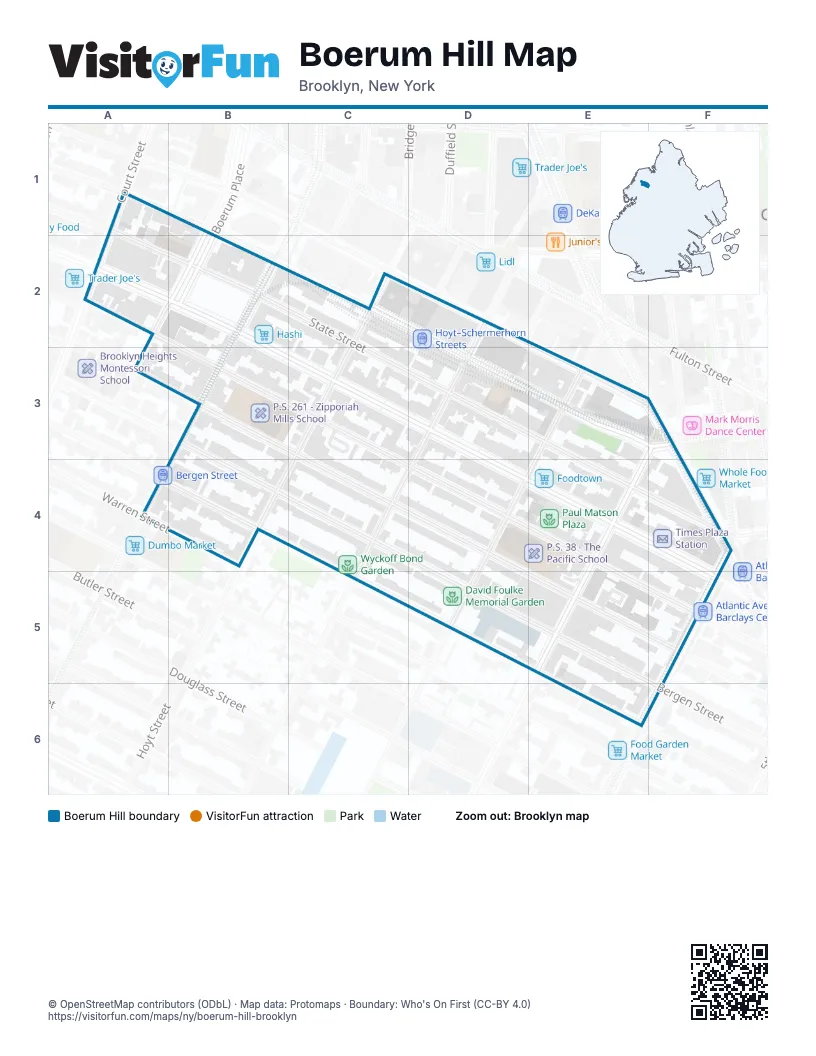
Street index of Boerum Hill
Each street on the sheet and the grid squares it crosses.
- State StreetA1, B2, C2, E3, E4, F4
- Atlantic AvenueA2, B2, E4, F4
- Boerum PlaceA2, B2
- Court StreetA2
- Pacific StreetA2, B3, E4
- Smith StreetB2, B3
- Hoyt StreetC2, C3
- Schermerhorn StreetC2, D3, E3, F3
- Hanover PlaceD2
- Livingston StreetD2, E3, F3
- Bergen StreetB3, D5, E5, F6
- Dean StreetB3, E5
- Bond StreetD3, C4
- Nevins StreetE3, D4, D5
- 3rd AvenueF3, E4, E5
- Flatbush AvenueF3, F4
- Lafayette AvenueF3
- 4th AvenueF4, F5, E6, F6
- Saint Marks PlaceE5, E6
- Wyckoff StreetE5
Places on the map
- 200 Dry Cleaners & Laundry Service
- 310 Art
- 3rd Avenue & Dean Street
- 3rd Avenue & State Street
- 44 Deli & Grill
- 490 Atlantic
- 4th Ave Pub
- 4th Avenue & Dean Street
- 7-Eleven
- 8-Bit Bites
- A. Fantis Parochial School
- About Coffee
- Absolute Coffee
- Ace Hotel Brooklyn
- AHF Healthcare Center
- AHF Pharmacy
- AHRC
- All Ears
- Allergy MD
- Alul Bayt Islamic Library
- Amazing Closeouts
- Amy's Professional African Hair Braiding
- Anaïs
- Angelica Pizza & Restaurant
- Anne Willi
- Anwaar Co.
- Apple Gourmet Farm
- Arab-American Family Support Center
- Arco
- Art World ESPO
- Assembly Line
- Atlantic Avenue & 3rd Avenue
- Atlantic Avenue & 4th Avenue
- Atlantic Avenue & Bond Street
- Atlantic Avenue & Court Street
- Atlantic Avenue & Hoyt Street
- Atlantic Avenue & Nevins Street
- Atlantic Avenue & Smith Street
- Atlantic Avenue-Barclays Center
- Atlantic Avenue–Barclays Center
© OpenStreetMap contributors (ODbL) · Map data: Protomaps · Boundary: Who's On First (CC-BY 4.0)