

New York map
Cambria Heights map
A printable two-page map of Cambria Heights (Queens, New York), drawn by VisitorFun from OpenStreetMap. Page two is the street index: every street on the sheet with its grid square, the same list as below.
Open the map (PDF, US Letter)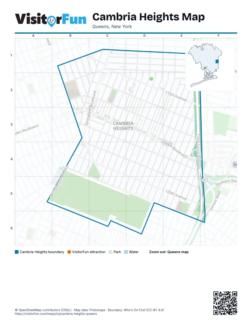
Street index of Cambria Heights
Each street on the sheet and the grid squares it crosses.
- 211th StreetB1, C2
- Murdock AvenueB1, C1, D1, E1
- 113th DriveC1, E1
- 114th AvenueC1, E1
- 114th RoadC1, E1
- 115th AvenueC1, C2, D2, E2, F2
- 212th StreetC1
- 217th StreetC1, C2, C3, B4
- Colfax StreetC1
- Delevan StreetC1
- Nashville BoulevardC1, B2, C2, B3
- Springfield BoulevardC1, C2, B3, C3, B4, A5, B5
- 220th StreetD1, C2, D2, C3, C4, B6
- 221st StreetD1, C2, D2, C3, C4, B6
- 222nd StreetD1, D2, C4, C5, B6
- 224th StreetD1, D2, D3, D4, C5, C6
- 225th StreetD1, D2, C5, C6
- 226th StreetE1, D2, E2, C5, C6
- 227th StreetE1, E2, D5
- Cross Island ParkwayE1, E2, E3, E4, E5, F5
- 116th AvenueB2, C2, E3
- 116th RoadB2, C2
- 207th StreetB2, B3
- 208th StreetB2
- 209th StreetB2
- 210th StreetB2, C2
- Francis Lewis BoulevardB2, B3, B4, C4, C5, D5
- 115th CourtC2
- 115th RoadC2, D2, E3
- 115th TerraceC2
- 218th StreetC2, C3, B4
- 219th StreetC2, C3, B4, C4, B5
- 223rd StreetD2, D3, C4, C5, C6
- 114th DriveE2
- 114th TerraceE2
- 228th StreetE2, D5
- 229th StreetE2, D5
- 230th StreetE2, D5
- 231st StreetE2, D5
- Dutch BroadwayF2
- 117th RoadB3, C3
- 118th AvenueB3, C3, E4
- 119th AvenueB3, B4, C4, E5
- Linden BoulevardB3, C3, E4
- 232nd StreetE3, E4, D5, E5
- 233rd StreetE3, E4, E5
- Cross Island Parkway Service RoadE3, E4
- 121st AvenueB4, C5, D5, E5, E6
- 120th AvenueC4, E5
- 234th StreetE4, E5
- 235th StreetE4, E5
- 236th StreetE4, E5
- Belt ParkwayE4, F4, F5, E6, F6
- 122nd AvenueB5
- 130th AvenueB5, B6
- Montefiore AvenueB5
- 237th StreetE5
- 238th StreetE5, E6
- Southern State ParkwayF5
- Laurelton ParkwayE6
Places on the map
- BP
- Cambria Heights
- Cambria Heights Civic Association Community Garden
- Cambria Heights Gospel Chapel
- Cambria Meat & Seafood Market
- Campus Magnet Educational Campus
- Cross Island Laundromat
- CVS Pharmacy
- Delphin H. Greene Playground
- East Springfield Playground
- Farmbria Food Center
- Frederick Cabbell Park
- Greater Bethel Church
- Harvest Revival Full Gospel Church
- Holy Trinity Parish Church
- KFC
- Laurelton Parkway West Playground
- McDonald's
- Montefiore Cemetery
- Old Springfield Cemetery
- P.S. / M.S. 147Q - The Ronald McNair School
- P.S. 176Q - The Cambria Heights School
- Palmer Cleaning Center
- Prince of Peace Lutheran Church
- Queens Public Library at Cambria Heights
- Sacred Heart Church
- Saint David's Episcopal Church
- Speedway
© OpenStreetMap contributors (ODbL) · Map data: Protomaps · Boundary: Who's On First (CC-BY 4.0)