

New York map
Floral Park map
A printable two-page map of Floral Park (Queens, New York), drawn by VisitorFun from OpenStreetMap. Page two is the street index: every street on the sheet with its grid square, the same list as below.
Open the map (PDF, US Letter)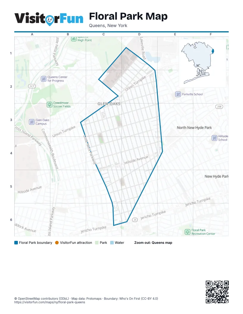
Street index of Floral Park
Each street on the sheet and the grid squares it crosses.
- 74th AvenueC1, C2
- 269th StreetD1, D2, D3
- 270th StreetD1, D2, D3
- 271st StreetD1, D2
- 76th AvenueD1, C2
- 77th AvenueD1, C2
- Hewlett StreetD1, D2
- 261st StreetC2, C3, D4, D5
- 262nd StreetC2, C3, D3, D5
- 263rd StreetC2, C3, D5
- 264th StreetC2, D2, D3, D5
- 265th StreetC2, D2, D3, D5
- 266th StreetC2, D2, D3, D4
- Union TurnpikeC2, D2, C3
- 267th StreetD2, D3, D4
- 268th StreetD2, D3, D4, E4
- 77th RoadD2
- 78th AvenueD2
- 79th AvenueD2, C3
- Langdale StreetD2, D3, E4
- 254th StreetB3, C4
- Little Neck ParkwayB3, C4, C5, C6
- 255th StreetC3, C4
- 256th StreetC3, C4, C5, C6, D6
- 257th StreetC3, C4, C6, D6
- 258th StreetC3, D5, D6
- 259th StreetC3, C4, D5, D6
- 260th StreetC3, D4, D5, D6
- 80th AvenueC3, D3
- 81st AvenueC3, D3, B4
- 82nd AvenueD3, E3
- 82nd DriveC4
- 82nd RoadC4
- 83rd RoadC4
- 85th AvenueD4, C5, D5
- East Williston AvenueD4, E4, C5, D5
- Emerson AvenueD4
- Hillside AvenueD4, E4
- Irving AvenueD4
- Cherry LaneE4
- Willis AvenueE4
- 84th DriveC5
- 84th RoadC5
- 87th AvenueC5, D5
- 86th AvenueD5
- Bryant AvenueD5
- Hawthorne AvenueD5
- Hinsdale AvenueD5
- Holland AvenueD5
- Vanderbilt AvenueD5
- Whitney AvenueD5
- Whittier AvenueD5
- 87th DriveC6
- 87th RoadC6, D6
- 87th TerraceC6
- Jamaica AvenueC6, D6
- Belmont AvenueD6
- Brokaw AvenueD6
- Jericho TurnpikeD6
- Lowell AvenueD6
- North Tyson AvenueD6
Places on the map
- 7-Eleven
- Apna Bazar
- Bellerose Jewish Center
- Cohen’s Children’s Medical Center
- CVS Pharmacy
- FDNY E251
- Hillside Park
- Katz Women's Hospital
- Long Island Jewish Medical Center
- M.S. 172Q - Irwin Altman Middle School
- Mavis Discount Tire
- Mobil
- NY Pillar Church
- Our Lady of the Snows Church
- P.S. 115Q - The James J. Ambrose School
- P.S. 191Q - Mayflower School
- Parker Jewish Institute for Health Care and Rehabilitation
- Premium Supermarket
- Queens Public Library at Glen Oaks
- Saint Paul's Lutheran Church
- Shiv Shakti Peeth Temple
- Zucker Hillside Hospital
Next to Floral Park
- New Hyde Park
- North New Hyde Park
© OpenStreetMap contributors (ODbL) · Map data: Protomaps · Boundary: Who's On First (CC-BY 4.0)