

New York map
Floyd Bennett map
A printable two-page map of Floyd Bennett (Brooklyn, New York), drawn by VisitorFun from OpenStreetMap. Page two is the street index: every street on the sheet with its grid square, the same list as below.
Open the map (PDF, US Letter)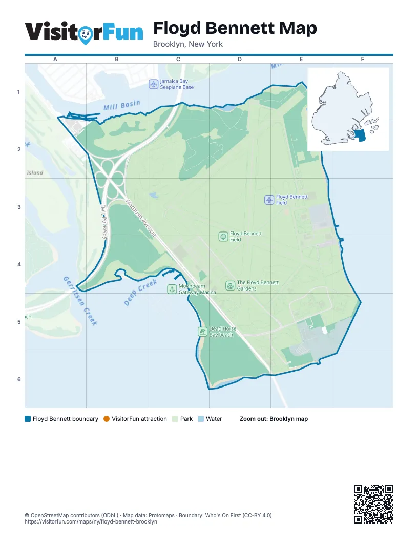
Street index of Floyd Bennett
Each street on the sheet and the grid squares it crosses.
- Belt ParkwayC1, B2, C2, B3, A4, B4
- Flatbush AvenueA2, B2, B3, C3, C4, D5, D6, E6
- Aviation RoadC3, E3, D4, D5, E5, E6
- Floyd Bennett DriveE4, D5, E5, F5
- Ranger RoadE4, E5
- Marine Parkway–Gil Hodges Memorial BridgeD6, E6
Places on the map
- 6th Communication Battalion, United States Marines
- Aviator Field
- Aviator Golf Center
- Aviator Mini-Golf Center
- Aviator Sports & Events Center
- Beach Grass Nursery
- Belt Parkway/Shore Parkway
- Compass Rose
- Dead Horse Bay beach
- Department of Sanitation Training Area
- Floyd Bennett Field
- Floyd Bennett Field Historic District
- Four Sparrow Marsh
- Goldenrod Campground
- North Forty Natural Area
- NYPD Air Operations Heliport (Floyd Bennett Field)
- NYPD Helipad
- Return-A-Gift Pond
- Tamarack Campground
- The Floyd Bennett Gardens
- Triborough Bridge And Tunnel Authority
- Turtle Reintroduction Site
- Wiley Post A
- Wiley Post B
© OpenStreetMap contributors (ODbL) · Map data: Protomaps · Boundary: Who's On First (CC-BY 4.0)