

New York map
Laurelton map
A printable two-page map of Laurelton (Queens, New York), drawn by VisitorFun from OpenStreetMap. Page two is the street index: every street on the sheet with its grid square, the same list as below.
Open the map (PDF, US Letter)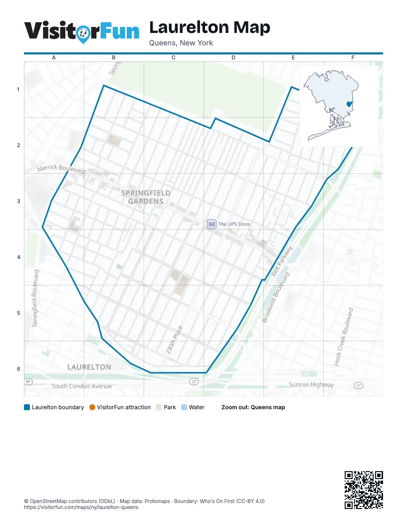
Street index of Laurelton
Each street on the sheet and the grid squares it crosses.
- 130th AvenueB1, D2, E2, E3, F3
- 130th DriveB1, B2
- 130th RoadB1, C1
- 217th StreetB1, B2, A3
- 218th StreetB1, B2, A3, B3, A4
- 220th StreetC1, B2, B3, A4, B4
- 121st AvenueE1, F1
- 125th AvenueE1
- 126th AvenueE1
- 233rd StreetE1, E2, D3, E3, D4, D5, C6
- Francis Lewis BoulevardE1, D2, E2, D3, D4, C5, D5
- 236th StreetF1, E2, F2, E3
- 237th StreetF1, F2, E3, F3, D4, E4
- Laurelton ParkwayF1, F2, D6
- 133rd AvenueA2, B2, C3, D3, E4
- 133rd RoadA2, B2, B3, E4
- Merrick BoulevardA2, B2, B3, C3, D3, D4, E4
- Springfield BoulevardA2, B2, A3
- Wells AvenueA2, A3
- 131st AvenueB2, C2, D2, D3, E3
- 132nd AvenueB2
- 132nd RoadB2
- 219th StreetB2, B3, A4
- 221st StreetB2, B3, B4
- Lucas StreetB2
- 222nd StreetC2, B3, B4
- 223rd StreetC2, B3, C3, B4, B5
- 224th StreetC2, C3, B4, B5
- 225th StreetC2, C3, B4, C4, B5
- 226th StreetC2, D2, C3, C4, B5
- 129th AvenueD2, E2, F2
- 227th StreetD2, C3, C4, B5
- 228th StreetD2, C3, D3, C4, C5, B6
- 229th StreetD2, D3, C6
- 230th StreetD2, D3, D4, C6
- 128th AvenueE2
- 128th DriveE2
- 128th RoadE2
- 231st StreetE2, D3, D4, C5, C6
- 232nd StreetE2, E3, D4, D5, C6
- 234th StreetE2, D4, E4, D6
- 235th StreetE2, E3
- 238th StreetF2
- 134th RoadA3, B3, C3, D4, E4
- 135th AvenueA3, C3, C4, D4
- 136th AvenueA3, B4
- 136th RoadA3
- 220th PlaceB3, B4
- 137th RoadA4, B4
- 138th AvenueA4, B4, C5
- 138th RoadA4, B4
- 139th AvenueA4, B5, C5, C6, D6
- Carson StreetA4, B5
- 137th AvenueB4, C4, D4, D5
- 234th PlaceD4, D5
- 141st AvenueB5, C6
- Mentone AvenueB5, B6, C6
- 230th PlaceC5, C6
- North Conduit AvenueC6
Places on the map
- Herbal Healing
- Key Food
- Laurelton Branch Queens Borough Public Library
- Laurelton Car Wash
- Laurelton Gardens
- Lebanon Seventh Day Adventist Church
- Linden Seventh Day Adventist Church
- Merrick Academy (old location)
- Merrick Farm Supermarket
- Mobile
- P.S. / I.S. 270 - The Gordon Parks School
- P.S. 132Q - The Ralph Bunche School
- Parts Authority
- Springfield Gardens Branch Jamaica Post Office
- St. Mary Magdalene Roman Catholic Church
- The UPS Store
- USPS Springfield Gardens Station 11413
- Walgreens
- Weisman Home Outlet
- Winners Church
© OpenStreetMap contributors (ODbL) · Map data: Protomaps · Boundary: Who's On First (CC-BY 4.0)