

New York map
Neponsit map
A printable two-page map of Neponsit (Queens, New York), drawn by VisitorFun from OpenStreetMap. Page two is the street index: every street on the sheet with its grid square, the same list as below.
Open the map (PDF, US Letter)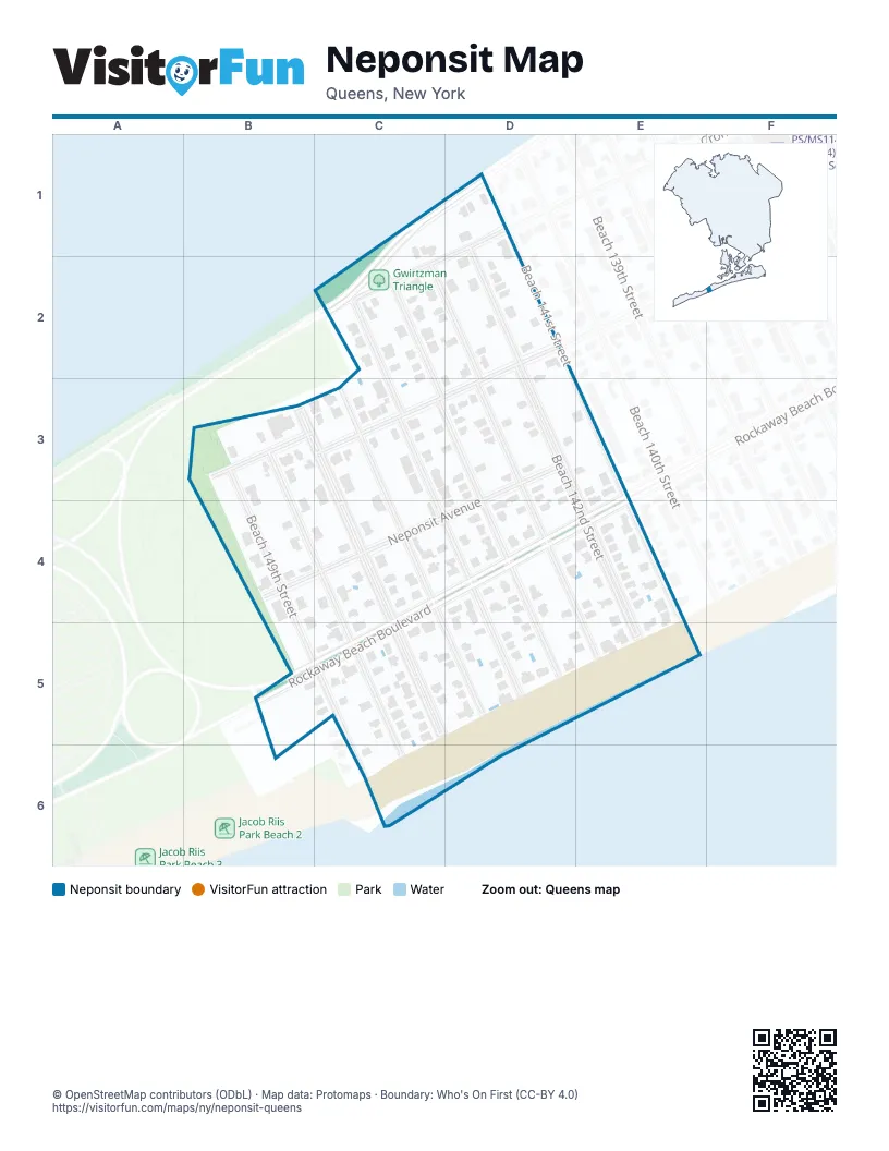
Street index of Neponsit
Each street on the sheet and the grid squares it crosses.
- Beach Channel DriveC1, C2
- Beach 142nd StreetD1, D2, D3, E5
- Cronston AvenueD1, C2
- Beach 143rd StreetC2, D3, D4, E5
- Beach 144th StreetC2, C3, D4, D5
- Beach 145th StreetC2, C3, D4, D5
- Beach 147th StreetB3, C3, C5
- Beach 148th StreetB3, C5, C6
- Beach 149th StreetB3, C5, C6
- Newport AvenueB3, C3
- Beach 146th StreetC3, C4, D5
- Neponsit AvenueD3, B4
- Beach 141st StreetE3, E4
- Rockaway Beach BoulevardC4, D4, E4, B5, C5
Places on the map
- Gwirtzman Triangle
- Neponsit
- Neponsit Mall
© OpenStreetMap contributors (ODbL) · Map data: Protomaps · Boundary: Who's On First (CC-BY 4.0)