

New York map
New York Navy Yard map
A printable two-page map of New York Navy Yard (Brooklyn, New York), drawn by VisitorFun from OpenStreetMap. Page two is the street index: every street on the sheet with its grid square, the same list as below.
Open the map (PDF, US Letter)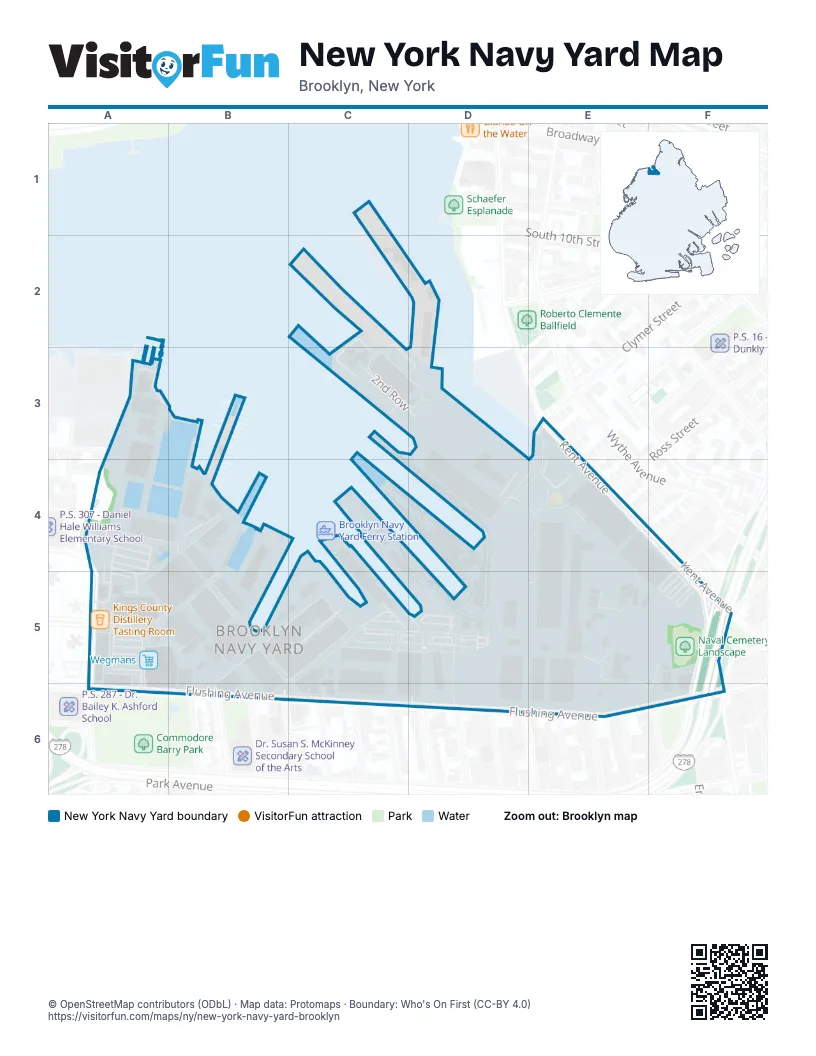
Street index of New York Navy Yard
Each street on the sheet and the grid squares it crosses.
- 2nd RowC3, D3
- Kent AvenueE3, E4, F5
- Navy Yard DriveE3, A5, D5
- Washington AvenueE3
- Wilson StreetE4
- Hooper StreetF4
- Keap StreetF4
- Navy StreetA5
- Sands StreetA5
- Brooklyn-Queens ExpresswayF5, F6
- Hewes StreetF5
- Williamsburg Street WestF5, F6
- 6th StreetB6
- Cumberland StreetB6
- North Elliott PlaceB6
- North Oxford StreetB6
- North Portland AvenueB6
- Adelphi StreetC6
- Carlton AvenueC6
- Clermont AvenueC6
- Clinton AvenueD6
- Flushing AvenueD6, F6
- Vanderbilt AvenueD6
- Waverly AvenueD6
Places on the map
- 1 Welding Road
- 25 Washington
- 33 Neilson Street
- Brooklyn Navy Hospital Ruins
- Brooklyn Navy Yard
- Brooklyn Navy Yard Center
- Brooklyn Navy Yard Historic District
- Building 101
- Building 102
- Building 103
- Building 104
- Building 105
- Building 140
- Building 144
- Building 202
- Building 204
- Building 209
- Building 213
- Building 215
- Building 216
- Building 218
- Building 240
- Building 292
- Building 31
- Building 311
- Building 321
- Building 322
- Building 340
- Building 344
- Building 364
- Building 365
- Building 371
- Building 45
- Building 70
- Building 77
- Building 86
- Building 88
- Building 98
- Building R1
- Building R4
© OpenStreetMap contributors (ODbL) · Map data: Protomaps · Boundary: Who's On First (CC-BY 4.0)