

New York map
Randall's Island map
A printable two-page map of Randall's Island (Manhattan, New York), drawn by VisitorFun from OpenStreetMap. Page two is the street index: every street on the sheet with its grid square, the same list as below.
Open the map (PDF, US Letter)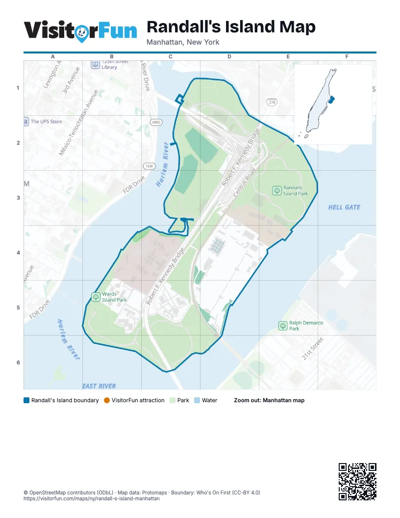
Street index of Randall's Island
Each street on the sheet and the grid squares it crosses.
- Bronx Shore RoadC1, D1, C2, D2, E2
- Robert F. Kennedy BridgeC1, D2, D3, C4, C5, C6
- Central RoadD2, E2, D3, C4, C5
- Sunken Meadow LoopE2, D3, E3
- K RoadD3
- Reilly BoulevardD3
- C RoadC4
- Hell Gate CircleC4, C5
- Rivers Edge RoadC4
- East River LaneB5, B6
- Sunken Garden LoopB5, C5
- Wards Meadow LoopB5, C5, B6, C6
Places on the map
- 1
- 2
- 3
- 4
- 5
- 50
- 6
- 71
- 8
- 81
- 9
- Clarke Thomas Men’s Shelter
- East River Lane
- George Rosenfeld Center for Recovery
- Harlem River Event Area
- Icahn Stadium
- Kirby Forensic Psychiatric Center
- Manhattan Psychiatric Center
- NYPD Harbor Unit
- Parking Lot E
- Parking Lot F
- Randall's Island Field #10
- Randalls Island
- Randalls Island Park
- Sportime Tennis
- Sunken Garden Loop
- Wards Island
- Wards Island Park
Next to Randall's Island
© OpenStreetMap contributors (ODbL) · Map data: Protomaps · Boundary: Who's On First (CC-BY 4.0)