

New York map
Terrace Heights map
A printable two-page map of Terrace Heights (Queens, New York), drawn by VisitorFun from OpenStreetMap. Page two is the street index: every street on the sheet with its grid square, the same list as below.
Open the map (PDF, US Letter)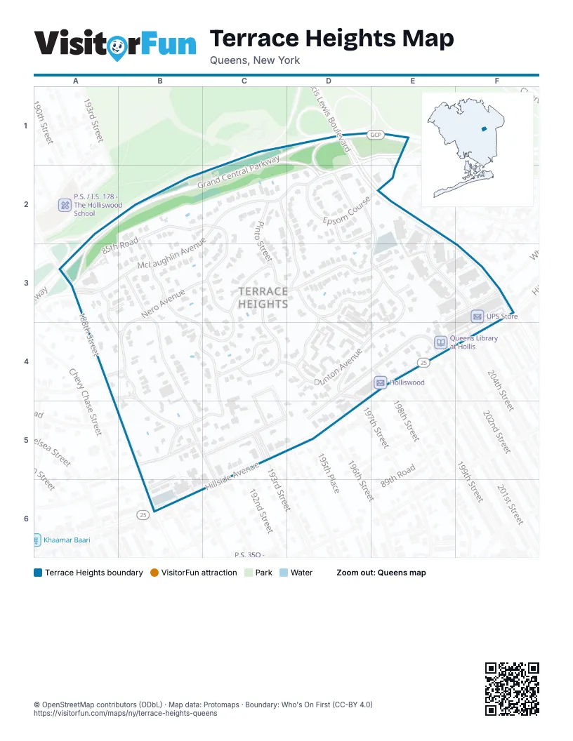
Street index of Terrace Heights
Each street on the sheet and the grid squares it crosses.
- Grand Central ParkwayC1, D1, E1, A2, B2, C2, A3
- Francis Lewis BoulevardD1, D2, E2, F3
- McLaughlin AvenueD1, C2, D2, A3, B3
- Epsom CourseE1, D2, E2
- 193rd StreetB2, B3, C5
- 85th RoadB2, C2, A3, B3
- Marengo StreetC2, D2, D3, D4
- Pinto StreetC2, C3, D3
- Sancho StreetC2, C3
- Dunton StreetD2, E2, E3
- Romeo CourtD2, E2
- Sutro StreetD2
- 204th StreetE2, E3, F3, F4
- 188th StreetA3
- Santiago StreetA3, B3, B4, B5
- Nero AvenueB3, C3, B4
- Palermo StreetB3, B4, C4, C5
- Palo Alto StreetB3, B4, B5
- Clio StreetC3, C4
- Como AvenueC3
- Keno AvenueC3, D3, E3, B4, C4
- Pompeii AvenueD3, E3, D4
- Dunton AvenueE3, C4, D4, E4
- Foothill AvenueE3, F3, D4, E4, C5, D5
- Pompeii RoadE3
- Whitehall TerraceF3
- Rio DriveA4, B4
- Soho DriveA4, B4
- Clover Hill RoadC4, C5
- Clover PlaceC4, C5
- Salerno AvenueC4
- 197th StreetD4
- 87th RoadD4
- 198th StreetE4
- 199th StreetE4
- 201st StreetE4
- 202nd StreetE4
- Hillside AvenueE4, F4, B6
- 191st StreetB5
- 87th DriveB5, B6
- Haywood RoadB5
- Palo Alto AvenueB5, C5
Places on the map
- Baituz-Zafar
- BP
- Foodtown
- Holliswood
- Queens Library at Hollis
- UPS Store
- Young Israel Of Holliswood
© OpenStreetMap contributors (ODbL) · Map data: Protomaps · Boundary: Who's On First (CC-BY 4.0)