

New York map
Vinegar Hill map
A printable two-page map of Vinegar Hill (Brooklyn, New York), drawn by VisitorFun from OpenStreetMap. Page two is the street index: every street on the sheet with its grid square, the same list as below.
Open the map (PDF, US Letter)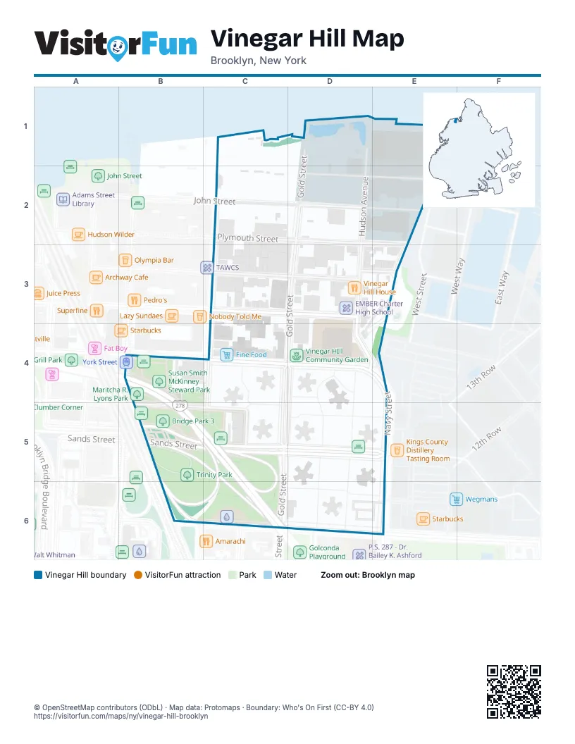
Street index of Vinegar Hill
Each street on the sheet and the grid squares it crosses.
- Gold StreetD1, D2, D3, C4, D4, C5, C6
- Hudson AvenueD1, D2, D3, D4
- Admiral Perry PlazaD2
- John StreetD2
- Marshall StreetD2, E2
- Plymouth StreetD2, E2
- Little StreetE2, E3
- Front StreetC3, D3
- Evans StreetD3, E3
- Water StreetD3
- Harrison AlleyE3
- Brooklyn-Queens ExpresswayB4, B5, C5, C6
- Jay StreetB4
- Talman StreetB4
- York StreetC4, D4
- Navy StreetD4, E4, E6
- Sands StreetB5, C5, D5, E5
- Bridge StreetC5
- Prospect StreetC5
- Nassau StreetC6, D6, E6
- Flushing AvenueE6
Places on the map
- Annie's First Wok Restaurant
- Area 53 Laser Tag
- Beat The Bomb
- Bridge Coffee Shop
- Bridge Courts
- Bridge Park 3
- Brooklyn House Residential Reentry Center
- Cafe Gitane
- Canaam Deli
- Carrage House
- Citi Bike - Bridge St & York St
- Citi Bike - Front St & Gold St
- Citi Bike - Nassau St & Duffield St
- Citi Bike - Nassau Street & Navy Street
- Citi Bike - Sands St & Jay St
- Digs
- Dorje Ling Buddhist Center
- DUMBO Gourmet Deli
- Dumbo Wellness
- EMBER Charter High School
- Farragut Houses
- Fine Food
- Gold Street & Sands Street
- Gold Street & York Street
- Hudson Avenue Generating Station
- Little Free Library
- Maritcha R. Lyons Park
- Matt Brenner
- Nick's Pharmacy
- P.S. 307 - Daniel Hale Williams Elementary School
- Plum
- Sands Street & Gold Street
- Susan Smith McKinney Steward Park
- Trinity Park
- Vinegar HIll Community Garden
- Vinegar Hill Historic District
- Vinegar Hill House
- Vinegar Hill Portrait Shop
- York Street
- York Street & Gold Street
© OpenStreetMap contributors (ODbL) · Map data: Protomaps · Boundary: Who's On First (CC-BY 4.0)