

Oklahoma road map
Cherokee Hills Byway map
The Cherokee Hills Byway has been a National Scenic Byway since 2009, named for its cultural qualities: about 85 miles in Oklahoma. It meets 8 highways, among them US 59, US 62 and US 64. Towns along it: Tahlequah, West Siloam Springs and Gore.
Open the map (PDF, US Letter)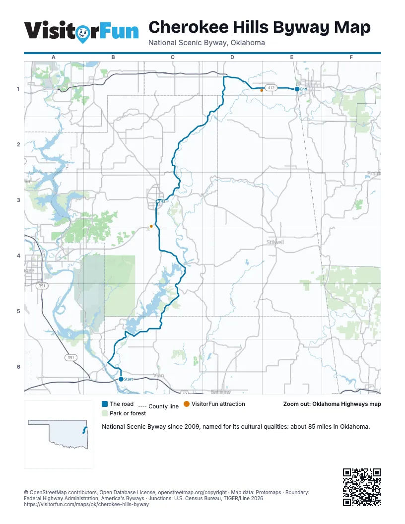
Highways it meets
Each highway it meets and the grid squares where they meet.
- US 64B6
- OK 10B6
- OK 100B6
- OK 82C5
- US 62C3
- OK 51C3
- US 412D1
- US 59D1
Towns along the Cherokee Hills Byway
In mile order, with the grid square of each.
- Carlislemile 0, B6
- Goremile 4, B6
- Notchietownmile 6, B6
- Redbird Smithmile 9, B5
- Paradise Hillmile 10, B5
- Blackgummile 15, C5
- Evening Shademile 17, C5
- Cooksonmile 22, C5
- Dry Creekmile 26, C4
- Caney Ridgemile 28, C4
- Tenkillermile 29, C4
- Pettitmile 31, C4
- Keysmile 31, C4
- Park Hillmile 35, C4
- Tahlequahmile 39, C3
- Wellingmile 45, C3
- Briggsmile 46, C3
- Sparrowhawkmile 48, C3
- Steely Hollowmile 50, C3
- Moodysmile 52, C2
- Cheweymile 65, D1
- Flint Creekmile 68, D1
- Kansasmile 70, D1
- Dripping Springsmile 77, D1
- West Siloam Springsmile 77, D1
Things to do on the Cherokee Hills Byway map
© OpenStreetMap contributors, Open Database License, openstreetmap.org/copyright · Map data: Protomaps · Boundary: Federal Highway Administration, America's Byways · Junctions: U.S. Census Bureau, TIGER/Line 2026