

Oklahoma map
Great Plains Country map
The sheet's index lists 13 highways; I-40, I-44 and US 62 cross the most grid squares. Things to do inside the boundary: Chisholm Trail Casino, Chisholm Trail Heritage Center and Comanche Nation Casino. Also on it: Altus, Anadarko and Clinton.
Open the map (PDF, US Letter)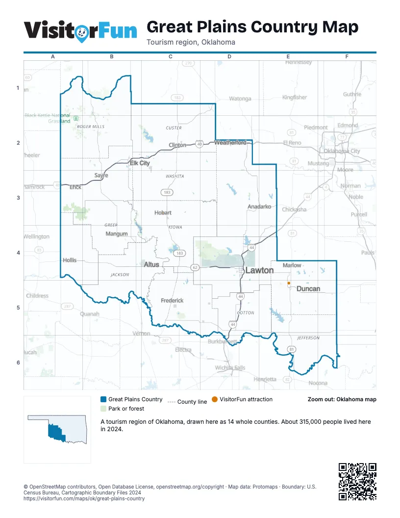
Highway index of Great Plains Country
Each highway on the sheet and the grid squares it crosses.
- I-40A3, B2, B3, C2, D2
- I-44D4, D5, D6, E4
- US 62A4, B4, C4, D4
- US 81E4, E5, E6
- US 183C1, C2, C3, C4
- US 277D4, D5, D6
- US 281D4, D5, D6
- OK 6B4
- OK 7D4, E4, E5, F5
- OK 9C3
- OK 33C2
- OK 34B2
- OK 47C1
Things to do on the Great Plains Country map
- Chisholm Trail Casino
- Chisholm Trail Heritage Center
- Comanche Nation Casino
- Comanche Red River Hotel Casino
- Comanche Spur Casino
- General Tommy Franks Leadership Institute and Museum
- Great Plains State Park
- Museum of the Great Plains
- Quartz Mountain Nature Park
- Stafford Air & Space Museum
- Washita Battlefield National Historic Site
Places on the map
- Altus
- Anadarko
- Clinton
- Duncan
- Elk City
- Erick
- Frederick
- Hobart
- Hollis
- Lawton
- Mangum
- Marlow
- Sayre
- Weatherford
Next to Great Plains Country
- Chickasaw Country map
- Frontier Country map
- Red Carpet Country map
- Panhandle Plains
- Prairies and Lakes
© OpenStreetMap contributors, Open Database License, openstreetmap.org/copyright · Map data: Protomaps · Boundary: U.S. Census Bureau, Cartographic Boundary Files 2024