

Tennessee map
Nashville-Davidson-Murfreesboro-Franklin Metro Area map
The sheet's index lists 32 highways; I-24, I-40 and I-65 cross the most grid squares. Things to do inside the boundary: Adventure Science Center, Andrew Jackson's Hermitage and Bell Witch Cave. Also on it: Brentwood, Carthage and Centerville.
Open the map (PDF, US Letter)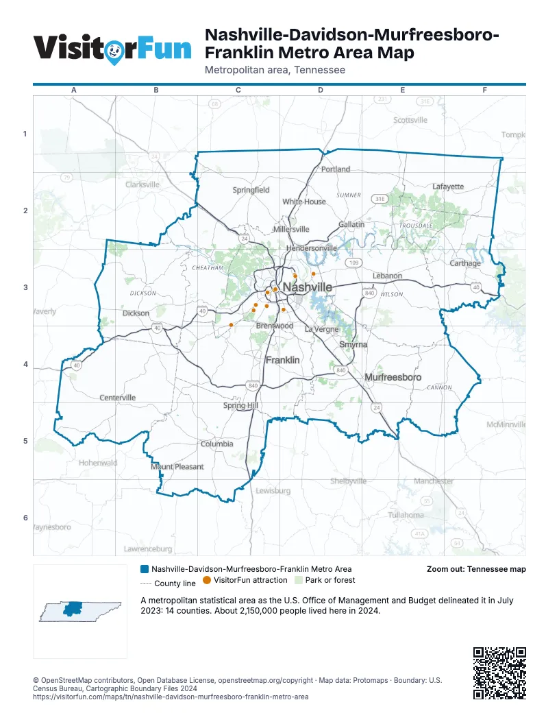
Highway index of Nashville-Davidson-Murfreesboro-Franklin Metro Area
Each highway on the sheet and the grid squares it crosses.
- I-24B2, C2, C3, D3, D4, E4, E5
- I-40A4, B3, B4, C3, D3, E3, F3
- I-65C3, C4, C5, D1, D2, D3
- I-440C3, D3
- I-840B4, C4, D3, D4, E3
- US 31C4
- US 31EC3, D2, D3, E1, E2
- US 41C2
- US 43B5, B6, C5
- US 70SE4, F4, F5
- US 231D5, E1, E2, E4, E5
- US 412B5, C5
- US 431C1, C2, C4
- TN 7B4, B5, C5
- SR 46B4
- TN 46B4
- SR 53E4
- SR 96C4
- TN 96B4, C4
- SR 100C4
- TN 100C4
- SR 109D1, D2, D3, E3
- SR 155C3, D3
- TN 155C3, D3
- SR 174D2
- SR 247B5
- SR 265E3
- SR 269D5
- TN 386D2, D3
- TN 396C5
- TN 397C4
- SR 665D2
Things to do on the Nashville-Davidson-Murfreesboro-Franklin Metro Area map
- Adventure Science Center
- Andrew Jackson's Hermitage
- Bell Witch Cave
- Belle Meade Historic Site & Winery
- Bicentennial Capitol Mall State Park
- Bridgestone Arena
- Centennial Park
- Cheekwood Estate & Gardens
- CoolSprings Galleria
- Country Music Hall of Fame and Museum
- Fort Negley
- Frist Art Museum
- Gaylord Opryland Resort
- Grand Ole Opry
- Honky Tonk Highway
- Johnny Cash Museum
- Lane Motor Museum
- Loveless Cafe
- Nashville Zoo at Grassmere
- Opry Mills
- Ryman Auditorium
- Stones River National Battlefield
- Tennessee State Museum
- The Avenue Murfreesboro
- The Bluebird Cafe
- The Escape Game Nashville
- The Mall at Green Hills
- The Parthenon
- Vanderbilt University Museum of Art
Places on the map
- Brentwood
- Carthage
- Centerville
- Columbia
- Dickson
- Franklin
- Gallatin
- Hendersonville
- La Vergne
- Lafayette
- Lebanon
- Millersville
- Mount Pleasant
- Murfreesboro
- Nashville
- Portland
- Smyrna
- Spring Hill
- Springfield
- White House
© OpenStreetMap contributors, Open Database License, openstreetmap.org/copyright · Map data: Protomaps · Boundary: U.S. Census Bureau, Cartographic Boundary Files 2024