

Texas map
Bexar County map
About 2,127,737 people live here (Census Bureau, 2024 estimate). The sheet's index lists 23 streets; Anderson Loop, Connally Loop and North Pan Am Expressway cross the most grid squares. Things to do inside the boundary: Buckhorn Saloon & Museum, Casa Catrina and Go Rio Cruises.
Open the map (PDF, US Letter)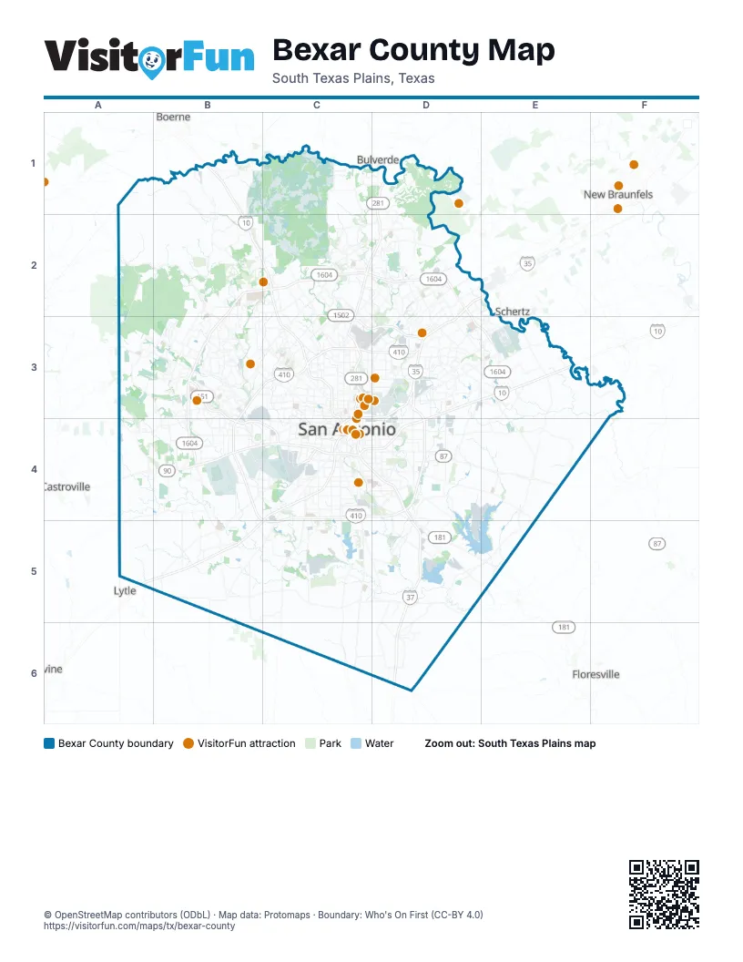
Maps inside Bexar County
1 map inside, from the street map of Bexar County down.
Street index of Bexar County
Each street on the sheet and the grid squares it crosses.
- Anderson LoopB2, C2, D2, B3, D3, E3, B4
- McDermott FreewayC2, C3, C4
- Vista del NorteC2
- Wurzbach ParkwayC2, C3, D3
- North Pan Am ExpresswayD2, E2, C3, D3, C4
- Purple Heart TrailE2, A5, B5, C5
- Connally LoopB3, C3, D3, B4, C4, D4, C5
- Stotzer FreewayB3, B4, C4
- McAllister FreewayC3, C4
- Northwest Loop 410C3
- William J Bordelon FreewayC3, C4
- 90th Infantry Division HighwayD3, E3, D4
- Buckhorn LaneD3
- Buzzi WayD3
- Tool YardD3
- Cleto Rodriguez FreewayB4, C4
- General Hudnell DriveC4
- Jose Lopez FreewayC4
- José López FreewayC4, D4
- Lucian Adams FreewayC4, D4
- South Pan Am ExpresswayC4, C5
- South Pan-American ExpresswayC4
- South US Highway 181D5
Things to do on the Bexar County map
- Buckhorn Saloon & Museum
- Casa Catrina
- Go Rio Cruises
- Go Rio San Antonio River Cruises
- Historic Market Square (El Mercado)
- Hopscotch
- Japanese Tea Garden
- LEGOLAND Discovery Center San Antonio
- Louis Tussaud's Waxworks
- Mad Dogs British Pub
- Majestic Theatre
- McNay Art Museum
- Morgan's Wonderland
- Old Town Trolley Tours of San Antonio
- San Antonio
- San Antonio Botanical Garden
- San Antonio Missions National Historical Park
- San Antonio Museum of Art
- San Antonio River Walk
- San Antonio Zoo
- SeaWorld San Antonio
- Six Flags Fiesta Texas
- Spanish Governor's Palace
- The Alamo
- The Amazing Mirror Maze
- The DoSeum
- The Pearl
- The Saga at San Fernando Cathedral
- The Scream Experiment
- The Witte Museum
- Tower of the Americas
Places on the map
- Acequia Park
- Alamo Downs Business Park
- Alamo Heights
- Alamo Junction Rail Park
- Alamo Quarry
- Alamo Ranch
- Amhurst
- Anaqua Springs Ranch
- Apache Creek Park
- Arcadia Ridge
- Army Residence Community
- Arrowhead
- Astoria Place
- Aum Sat Tat Ranch
- Autumn Ridge
- Autumn Run
- Avenida Guadalupe
- Babcock Place
- Balcones Creek
- Balcones Heights
- Bamberger Nature Park
- Bandera Pointe
- Beacon Hill
- Beckmann Quarry
- Bella Vista
- Bentley Manor
- Beverly Hills
- Bexar County
- Big Oak Estates
- BJ Services
- Bloomfield Hills
- Blossom Athletic Center
- Blue Skies
- Blue Skies of Texas
- Blue Wing Lake
- Boysville
- Brackenridge Golf Course
- Braun Heights
- Braun Oaks
- Braun Station
Next to Bexar County
- Boerne
- Bulverde
- Castroville
- Cibolo
- Devine
- Floresville
- Lytle
- New Braunfels
- Schertz
© OpenStreetMap contributors (ODbL) · Map data: Protomaps · Boundary: Who's On First (CC-BY 4.0)