

Texas map
Cameron County map
About 431,874 people live here (Census Bureau, 2024 estimate). The sheet's index lists 5 streets; Texas Vietnam Veterans Memorial Highway, U.S. Highway 77 and North Expressway cross the most grid squares. Also on it: Abbott Reservoir, Acacia Lake and Adams Winter Garden Reservoir.
Open the map (PDF, US Letter)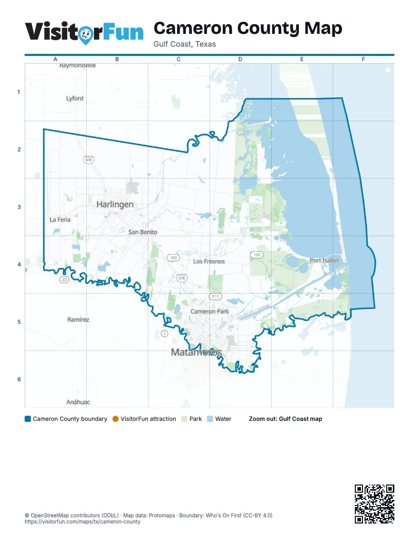
Street index of Cameron County
Each street on the sheet and the grid squares it crosses.
- U.S. Highway 77A2, B2, B3
- Texas Vietnam Veterans Memorial HighwayA3, B3, B4, C4
- North ExpresswayC4, C5
- I-169, TX 550 TollD4
- South ExpresswayC5
Places on the map
- Abbott Reservoir
- Acacia Lake
- Adams Winter Garden Reservoir
- Adolph Thomae Jr. County Park
- Arroyo Colorado
- Bahia Grande
- Bayside Lake
- Bayview
- Boca Chica Bay
- Boca Chica Beach
- Brazos Island
- Brownsville
- Brownsville Golf Center
- Brownsville Landfill
- Brownsville Sports Park
- Cain Reservoir 1
- Cain Reservoir 2
- Calle Galaxia
- Cameron County
- Cameron Crossing
- Cayo Atascoso
- Citadel
- Clark Island
- Combes
- Cross Lake
- Cuates Lake
- El Chaparral
- El Valle Grande
- Fun-N-Sun RV Resort
- Harlingen
- Harlingen Ship Channel
- Heritage
- Heron Cove Estate
- Indian Lake
- Isla Blanca Park
- Keppel AmFELS
- La Feria
- La Feria Reservoir
- Laguna Atascosa
- Laguna Atascosa National Wildlife Refuge
Next to Cameron County
- Anáhuac
- El Control
- Lyford
- Matamoros
- Ramírez
- Raymondville
© OpenStreetMap contributors (ODbL) · Map data: Protomaps · Boundary: Who's On First (CC-BY 4.0)