

Washington road map
Washington highway map
7 Interstate routes run about 742 miles in Washington, each on a sheet of its own. The sheet's index lists 35 highways; I-90, I-5 and US 12 cross the most grid squares. Towns on it: Seattle, Spokane and Tacoma.
Open the map (PDF, US Letter)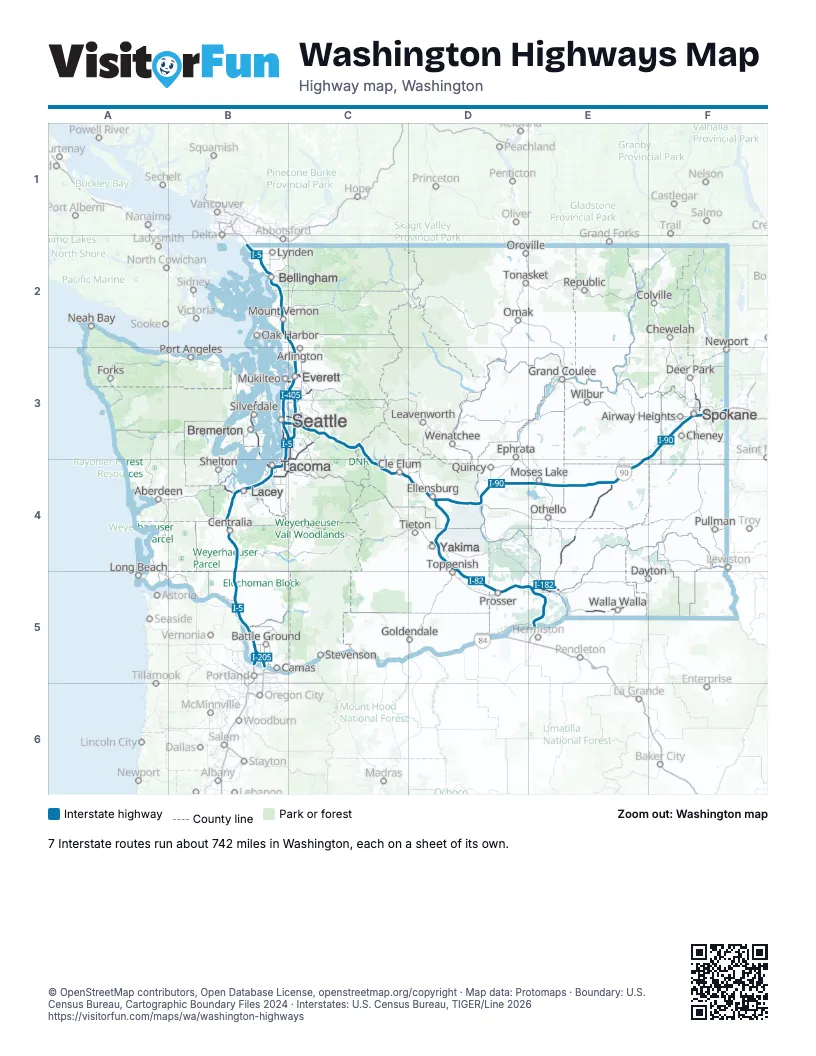
Road maps of Washington
13 road maps: each Interstate and byway on a sheet of its own.
Highway index of Washington
Each highway on the sheet and the grid squares it crosses.
- I-5B2, B3, B4, B5, C2, C3
- I-82D4, D5, E5
- I-90B3, C3, C4, D4, E3, E4, F3
- I-182E5
- I-205B5
- I-405C3
- I-705B4
- US 2C3, F3
- US 12B4, D4, D5, E5
- US 97D4
- US 101B4
- US 195F3
- US 395E3, E4, E5, F3
- SR 3B3
- SR 7B4
- SR 8B4
- SR 14B5
- SR 16B3, B4
- SR 18B3, B4, C3, C4
- SR 99B3
- SR 161B4
- SR 167B4, C3, C4
- SR 240E5
- SR 290F3
- SR 410C4
- SR 432B5
- SR 500B5
- SR 509B3
- SR 512B4
- SR 518B3, C3
- SR 520B3, C3
- SR 522C3
- SR 525B3, C3
- SR 526B3, C3
- SR 599B3
Places on the map
- Aberdeen
- Airway Heights
- Arlington
- Battle Ground
- Bellingham
- Bremerton
- Camas
- Centralia
- Cheney
- Chewelah
- Cle Elum
- Colville
- Dayton
- Deer Park
- Ellensburg
- Ephrata
- Everett
- Forks
- Goldendale
- Grand Coulee
- Lacey
- Leavenworth
- Long Beach
- Lynden
- Moses Lake
- Mount Vernon
- Mukilteo
- Neah Bay
- Newport
- Oak Harbor
- Omak
- Oroville
- Othello
- Port Angeles
- Prosser
- Pullman
- Quincy
- Republic
- Seattle
- Shelton
- Silverdale
- Spokane
- Stevenson
- Tacoma
- Tieton
- Tonasket
- Toppenish
- Walla Walla
- Wenatchee
- Wilbur
- Yakima
© OpenStreetMap contributors, Open Database License, openstreetmap.org/copyright · Map data: Protomaps · Boundary: U.S. Census Bureau, Cartographic Boundary Files 2024 · Interstates: U.S. Census Bureau, TIGER/Line 2026















