

Wisconsin map
Ellison Bay map
The sheet's index lists 38 streets; Garrett Bay Road, Rustic Lane and State Highway 42 cross the most grid squares. Also on it: Bayview Resort, Blue Bear and Dance ring.
Open the map (PDF, US Letter)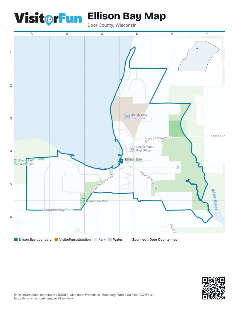
Street index of Ellison Bay
Each street on the sheet and the grid squares it crosses.
- Maplewood DriveD1, E1
- North Maplewood LaneD1
- South Maplewood LaneD1, D2
- Bluebird LaneD2
- Bluebird TrailD2, D3
- Garrett Bay RoadD2, E2, D3, D4
- Orchard LaneD2
- Rustic LaneC3, D3, C4, D4
- Appletree LaneD3
- Birchwood RoadD3, E3
- Ellison Bluff RoadA4, A5
- Grasse LaneB4, A5
- Hillside DriveB4, B5, C5
- Cedar BranchC4, D4
- Big Pine LaneD4
- Cedar Shore RoadD4
- Lakeview RoadD4, D5
- Mink River RoadD4, D5, E5
- Ranch LaneD4
- School RoadD4
- State Highway 42D4, E4, C5, D5
- Hanson DriveB5, B6
- Bay LaneC5
- High Road LaneC5
- Humbug RoadC5
- Anderson CourtD5
- Carlson CourtD5
- Cottage Glen DriveD5
- Eliason LaneD5
- Jensen DriveD5
- Klenke LaneD5
- Olson DriveD5
- Prinsen Woods RoadD5
- Ruckert LaneD5
- Sunnyside LaneD5, E5
- Porcupine Bay RoadA6, B6
- Dragonfly LaneE6, F6
- Central RoadF6
Places on the map
- Bayview Resort
- Blue Bear
- Dance ring
- Door County North Welcome Center
- Ellison Bay Beach/Ellison Bay Women's Club
- Ellison Bay Cemetery
- Ellison Bay Pottery
- Ellison Bay Town Hall
- Grandview Park
- Island Orchard Cider
- Kick Ash
- Liberty Grove Cemetery
- Moonbird Gallery
- Nicolet National Bank
- Norrland Resort
- Pioneer Store
- Savory Spoon Cooking School
- Star gazing ring
- The Clearing Folk School
- The Ellison
- Unit 1
- Unit 2
- Unit 3
- Unit 4
- Unit 5
- Unit 6
- United States Post Office
- Viking Fish Boil
- Will's Park
- William Caxton Books
© OpenStreetMap contributors (ODbL) · Map data: Protomaps · Boundary: Who's On First (CC-BY 4.0)