

Wisconsin map
Town of Brussels map
About 1,089 people live here (Census Bureau, 2024 estimate). The sheet's index lists 64 streets; State Highway 57, County Road D and County Road C cross the most grid squares. Also on it: Brussels (WIS 57/County C), Brussels Community Center and Brussels General Store.
Open the map (PDF, US Letter)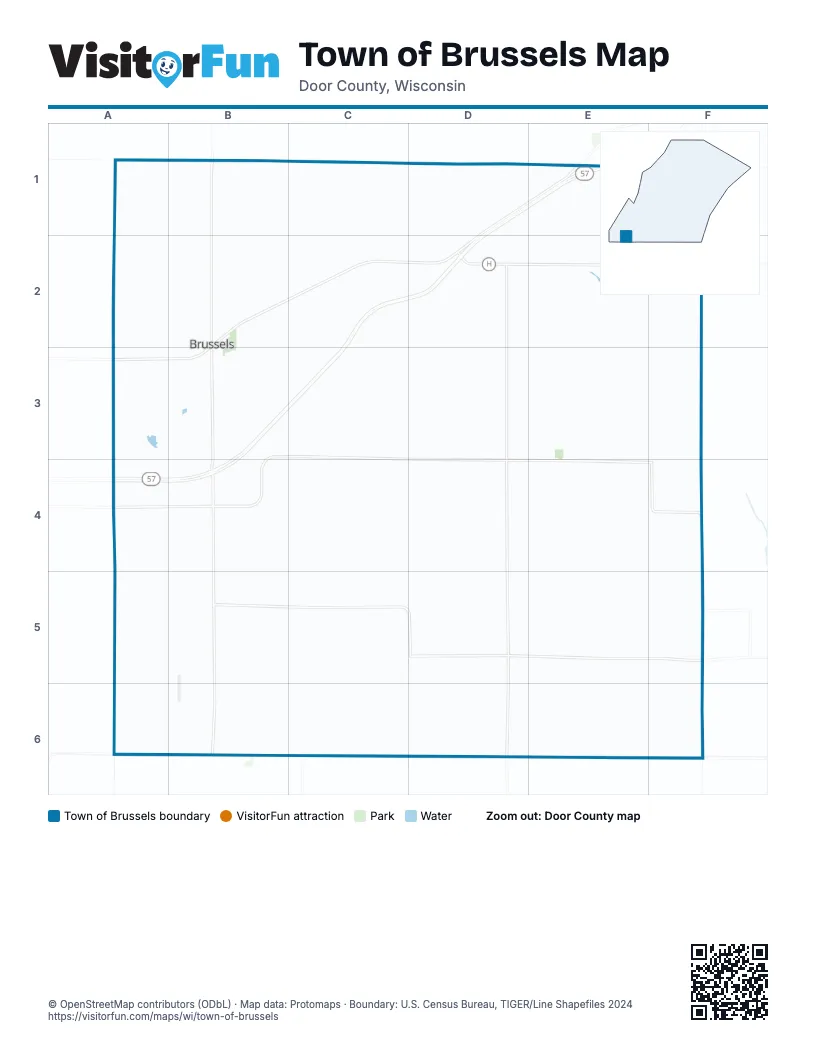
Street index of Town of Brussels
Each street on the sheet and the grid squares it crosses.
- Brussels RoadA1, A2, A3, A4, A5
- Gardner RoadA1, B1
- Plainview RoadA1, B1, A2, A3
- County Road CB1, B2, B3, B4, B5, B6, C6
- Dead End RoadB1, B2
- Cedar LaneD1
- County Road DKD1, E1, B2, C2, D2, A3, B3
- Morning View RoadD1
- Orchard View LaneD1, C2, D2
- State Highway 57D1, E1, C2, D2, B3, C3, A4, B4
- Tee Off LaneD1, D2
- Ullman CourtD1, D2
- Elm RoadE1, D6
- South Stevenson Pier RoadE1, E2, E3, E4
- Tornado RoadE1
- Anschutz RoadF1
- Crook RoadF1, F2
- Cemetery RoadA2, B2, C2
- Sawmill RoadA2
- Junction RoadB2, B3
- Mathey RoadB2
- Swamp CourtC2, C3
- Boulder RoadD2
- County Road HD2, E2, F2
- County Road XCD2, D3, D4, D5, D6
- Delwiche RoadD2
- Dump RoadD2, D3
- Renier RoadD2, E2
- Nienas RoadE2
- Curve RoadF2, E3, F3, F4
- School DriveF2
- County Road DB3, C3, A4, B4, D4, E4, F4, F5
- Pine RoadB3
- Rica LaneB3, B4
- Roosevelt CourtB3
- School RoadB3, C3, D3
- Misere CourtC3
- Misere RoadC3, C4, C5, C6
- Kolberg RoadE3, E4, E5
- Nell RoadF3
- Side RoadF3
- Old Brussels RoadA4
- Sams RoadA4, B4
- Hump RoadB4, C4
- Roosevelt RoadB4, B5
- Snow RoadB4
- Hafeman RoadC4, D4
- Larrys RoadC4
- Flat RoadD4, E4
- North Town Hall RoadD4, C5, D5
- Rabbit RoadD4, E4, F4
- Rouer RoadD4
- Marsh RoadE4, E5, E6
- Low RoadA5, B5, C5
- Star Road WestA5, B5
- County Road JB5, C5, D5, E5, F5
- Crow RoadB5, C5
- Slow RoadB5
- South Town Hall RoadD5, D6
- Star Road EastD5
- County Road XA6, B6, C6, D6
- Swamp RoadA6, B6
- Church RoadB6
- Swamp Road EastB6, C6
Places on the map
- Brussels (WIS 57/County C)
- Brussels Community Center
- Brussels General Store
- Brussels Hill
- Brussels Park
- Dollar General
- Marchant's Foods Inc.
- Mick Shier Field
- Saint Michaels Cemetery
- Town of Brussels
- United States Postal Service
© OpenStreetMap contributors (ODbL) · Map data: Protomaps · Boundary: U.S. Census Bureau, TIGER/Line Shapefiles 2024