

Wisconsin map
Town of Marshfield map
About 17,907 people live here (Census Bureau, 2024 estimate). The sheet's index lists 35 streets; Stadt Road, Day Road and US Highway 10 cross the most grid squares. Also on it: Evergreen Hill School.
Open the map (PDF, US Letter)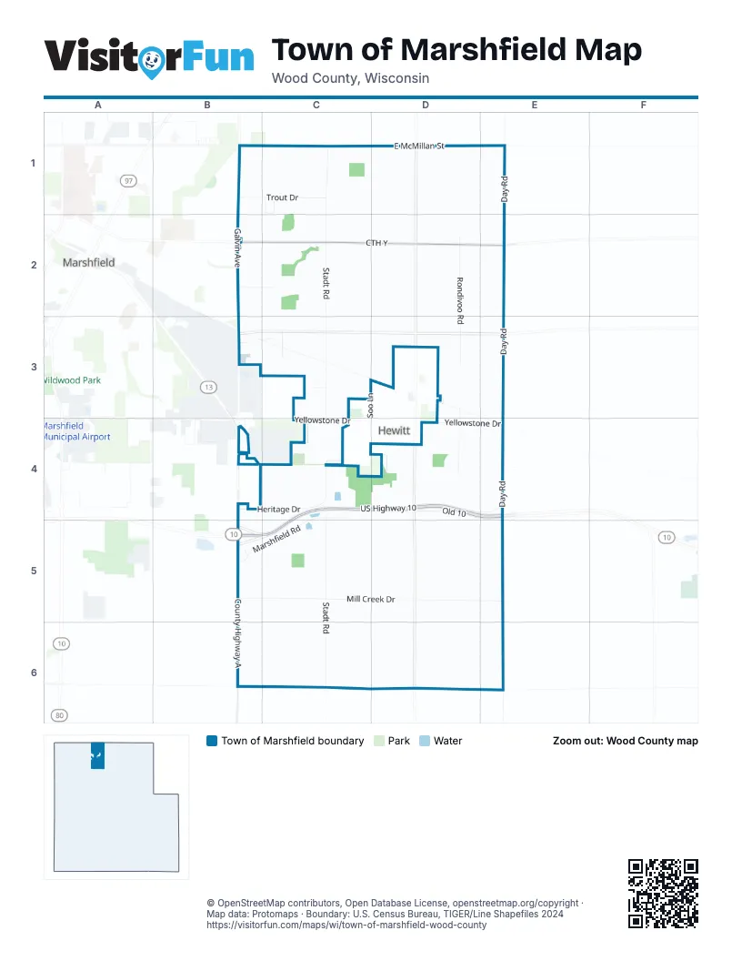
Street index of Town of Marshfield
Each street on the sheet and the grid squares it crosses.
- North Galvin AvenueB1, B2, B3
- Trout DriveB1, C1
- East McMillan StreetC1, D1, E1
- Staadt AvenueC1
- Stadt RoadC1, C2, C3, C4, C5, C6
- Weiler WayC1
- Day AvenueE1
- Day RoadE1, E2, E3, E4, E5
- CTH YB2, C2, D2, E2
- East Arnold StreetB2
- East Fillmore StreetB2
- East Hintz StreetB2
- Forest StreetB2
- Lawraine StreetB2
- Meadowbrook DriveB2
- Pheasant LaneB2, C2
- North Rondivoo RoadD2, D3
- East 4th StreetB3
- Short LaneB3
- South Galvin AvenueB3
- Milling LaneC3
- Porp CourtC3
- Soo LaneC3
- South Rondivoo RoadD3, D4
- Heritage DriveB4, C4
- South Draxler DriveB4
- Veterans ParkwayB4, B5
- Marshfield RoadC4, B5, C5
- US Highway 10C4, D4, E4, B5, C5
- Yellowstone DriveC4, D4, E4
- Old 10D4, E4
- Robin LaneE4
- County Highway AB5, B6
- Mill Creek DriveB5, C5, D5, E5
- Township CourtB5
Places on the map
- Evergreen Hill School
Next to Town of Marshfield
- Hewitt
- Marshfield map
© OpenStreetMap contributors, Open Database License, openstreetmap.org/copyright · Map data: Protomaps · Boundary: U.S. Census Bureau, TIGER/Line Shapefiles 2024















