

Wisconsin map
Town of Union map
About 990 people live here (Census Bureau, 2024 estimate). The sheet's index lists 63 streets; County Road DK, State Highway 57 and Tru-Way Road cross the most grid squares. Also on it: Belgian Heritage Center, Chaudoir's Dock and Chaudoirs Dock County Park.
Open the map (PDF, US Letter)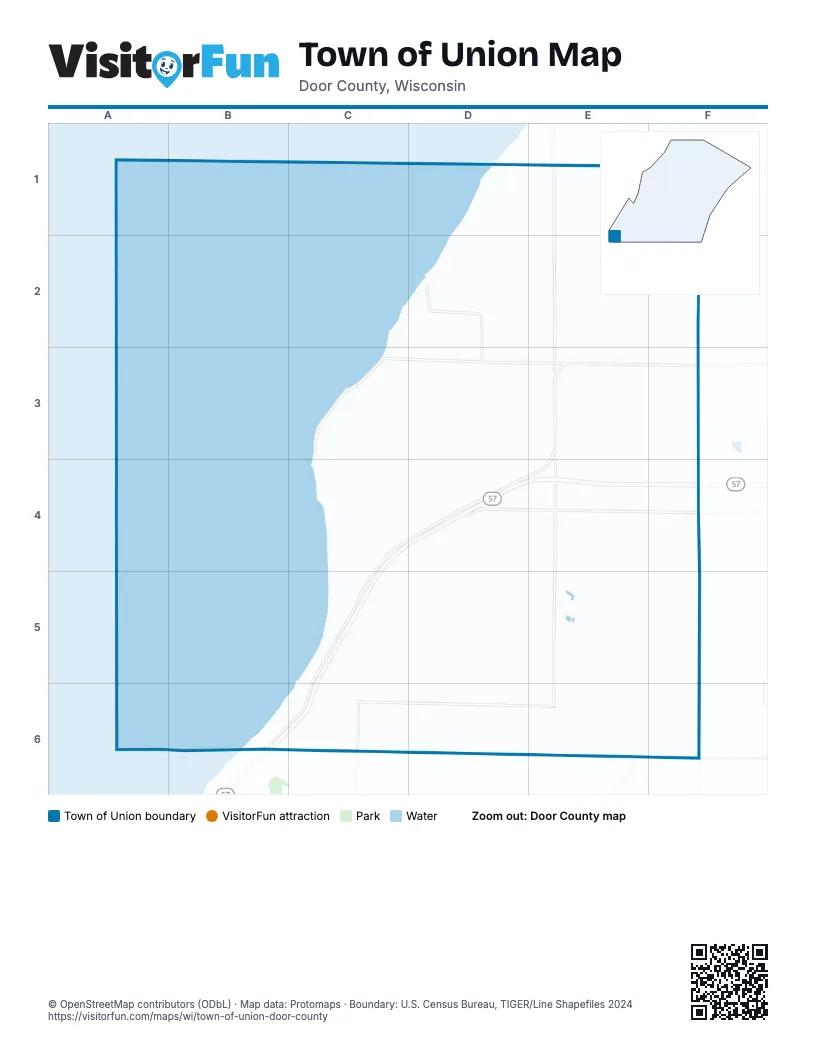
Street index of Town of Union
Each street on the sheet and the grid squares it crosses.
- Skeet AvenueD1, E1
- County Road NE1, D2, E2, D3, E3
- Dead End RoadE1, F1
- Gardner RoadE1, F1
- Pit RoadE1, E2, E3, E4, E5
- Rays RoadE1, F2
- Brussels RoadF1, F2, F3
- Tru-Way RoadF1, F2, F3, F4, F5, F6
- North Bayshore RoadC2, D2, C3
- Bent RoadD2
- Chaudoirs Dock RoadD2
- Forest Murmur RoadD2
- Ledge RoadD2, E2, F2
- Pleasant Ridge RoadD2, D3, D4, E4
- Cemetery RoadF2
- Sawmill RoadF2
- Bayshore RoadC3, D3
- Shoemaker Point RoadC3, C4
- Shoemaker RoadC3, D3, C4, D4
- Short RoadC3, C4
- Belgian DriveD3, E3
- Belgian LaneD3
- Rass RoadD3, D4
- Ross RoadD3
- County Road DKE3, F3, C4, D4, E4, C5, B6, C6
- County Road YE3, E4, E5, C6, D6, E6
- Oakwood Beach RoadC4
- Oakwood RoadC4
- Sandbar Beach RoadC4, C5
- Stage RoadC4, D4
- State Highway 57C4, D4, E4, F4, C5, B6, C6
- County Road DD4, E4, F4
- Sandhill CourtD4
- Sandhill RoadD4, D5, D6
- Woods RoadE4
- Bob's RoadF4
- Old Brussels RoadF4
- Pine RoadF4
- Arrowhead Beach RoadC5
- Beauty View CourtC5
- Beauty View RoadC5
- Breezy Acres RoadC5, B6, C6
- Cedar RoadC5, D5
- Rocky Circle RoadC5, D5
- Rocky LaneC5
- Rocky RoadC5, C6
- Stub RoadD5, D6
- Lester RoadE5
- Quail RoadE5
- Draize RoadF5
- Low RoadF5
- Chapel LaneB6, C6
- County Line RoadB6, C6, D6
- Sugar Maple DriveB6, C6
- Sun and Surf DriveB6
- Sun-N-Surf DriveB6
- County Road ABC6
- Duvall CourtC6
- Rustic Oak DriveC6
- County Road XE6, F6
- Partridge RoadE6
- Swamp RoadE6, F6
- Red River Lincoln T L RoadF6
Places on the map
- Belgian Heritage Center
- Chaudoir's Dock
- Chaudoirs Dock County Park
- Duvall Cemetery
- Saint Marys Cemetery
- Town of Union
© OpenStreetMap contributors (ODbL) · Map data: Protomaps · Boundary: U.S. Census Bureau, TIGER/Line Shapefiles 2024