

West Virginia map
Mountaineer Country map
The sheet's index lists 13 highways; I-79, US 119 and US 250 cross the most grid squares. Things to do inside the boundary: Coopers Rock State Forest. Also on it: Bridgeport, Cheat Lake and Clarksburg.
Open the map (PDF, US Letter)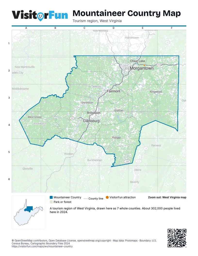
Highway index of Mountaineer Country
Each highway on the sheet and the grid squares it crosses.
- I-68D2, E2, F2
- I-79C3, C4, C5, D1, D2, D3
- US 19D3
- US 33D5
- US 48D5
- US 50A4, B4, C4
- US 119D2, D3, D4, E2, E3
- US 219F4
- US 250C2, C3, D3, D4, D5
- WV 43E1, E2
- WV 92D5
- WV 218C3
- WV 273D3
Things to do on the Mountaineer Country map
Places on the map
- Bridgeport
- Cheat Lake
- Clarksburg
- Fairmont
- Grafton
- Kingwood
- Morgantown
- Philippi
- Shinnston
- West Union
Next to Mountaineer Country
- Western Maryland
- Laurel Highlands
- Pittsburgh & Its Countryside
- Mid-Ohio Valley map
- Mountain Lakes
- Northern Panhandle map
- Potomac Highlands map
© OpenStreetMap contributors, Open Database License, openstreetmap.org/copyright · Map data: Protomaps · Boundary: U.S. Census Bureau, Cartographic Boundary Files 2024