

West Virginia map
Potomac Highlands map
The sheet's index lists 15 highways; US 48, US 250 and WV 55 cross the most grid squares. Things to do inside the boundary: Blackwater Falls State Park, Cass Scenic Railroad State Park and Dolly Sods Wilderness. Also on it: Beverly, Elkins and Franklin.
Open the map (PDF, US Letter)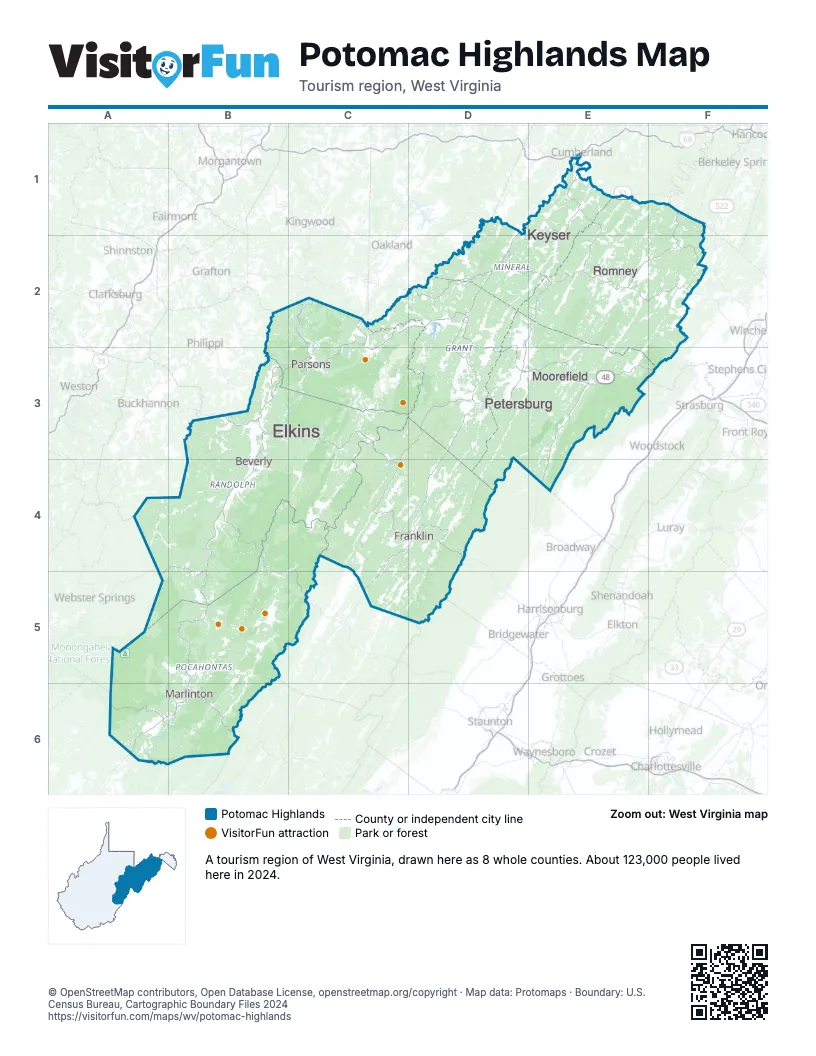
Highway index of Potomac Highlands
Each highway on the sheet and the grid squares it crosses.
- US 33B3
- US 48B3, C2, C3, D2, D3, E3, F3
- US 219B3, B4, C2, C3
- US 250B3, B4, B5, C4, C5
- WV 9F1
- WV 28B5, C4
- WV 29F1, F2
- WV 32C2, C3
- MD 51E1
- WV 55B3, B4, D3, E3, F3
- WV 72C3
- WV 92B3, B4, B5
- WV 93C2, C3, D2
- WV 127F2
- WV 259E3
Things to do on the Potomac Highlands map
Places on the map
- Beverly
- Elkins
- Franklin
- Keyser
- Marlinton
- Moorefield
- Parsons
- Petersburg
- Romney
Next to Potomac Highlands
- Western Maryland
- Shenandoah Valley
- Virginia Mountains
- Eastern Panhandle map
- Mountain Lakes
- Mountaineer Country map
- New River-Greenbrier Valley map
© OpenStreetMap contributors, Open Database License, openstreetmap.org/copyright · Map data: Protomaps · Boundary: U.S. Census Bureau, Cartographic Boundary Files 2024